By Brian Campued
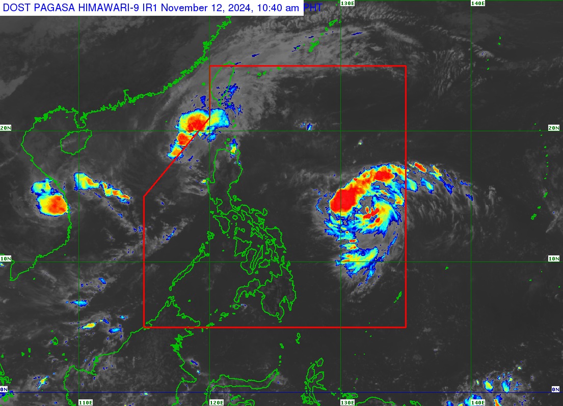
A tropical storm has entered the Philippine area of responsibility (PAR) and was named “Ofel” (international name: Usagi) as Severe Tropical Storm Nika (international name: Toraji) approaches the PAR boundary on Tuesday, the state weather bureau said.
In a tropical cyclone bulletin issued at 11:00 a.m., the Philippine Atmospheric, Geophysical and Astronomical Services Administration (PAGASA) said Ofel was located 950 kilometers east of southeastern Luzon, moving northwestward at 35 kilometers per hour.
The tropical storm packs maximum sustained winds of 85 kph and gustiness of up to 105 kph.
No Tropical Cyclone Wind Signal (TCWS) is currently hoisted as Ofel is not directly affecting any part of the country.
However, TCWS No. 1 may be raised over portions of Cagayan Valley Tuesday evening or Wednesday morning (Nov. 13), with the highest signal to be hoisted at TCWS No. 4.
Based on its track forecast, PAGASA said Ofel will continue to intensify and may reach typhoon category on Wednesday (Nov. 13) or Thursday (Nov. 14).
Ofel is also forecast to reach peak intensity prior to landfall over Northern or Central Luzon Thursday.
Meanwhile, “Nika” was spotted 225 km west northwest of Laoag City, Ilocos Norte, moving west-northwestward at 10 kph.
It packs winds of 95 kph near the center and gustiness of up to 115 kph.
TCWS No. 1 is raised over the following areas:
- Northern portion of Ilocos Norte (Sarrat, Piddig, Bangui, Vintar, Burgos, Pagudpud, Bacarra, Adams, Pasuquin, Carasi, San Nicolas, Dumalneg, Laoag City)
- Northern portion of Apayao (Luna, Calanasan)
- Northwestern portion of Cagayan (Abulug, Pamplona, Sanchez-Mira, Santa Praxedes, Claveria)
- Northwestern portion of Babuyan Islands (Calayan Island, Dalupiri Island, Fuga Island)
Nika will exit the PAR Tuesday afternoon, PAGASA said.
—iro
