Oil spill reaches Tablas Strait, Tayabas Bay

(Photo courtesy of PhilSA)

By Gabriela Baron

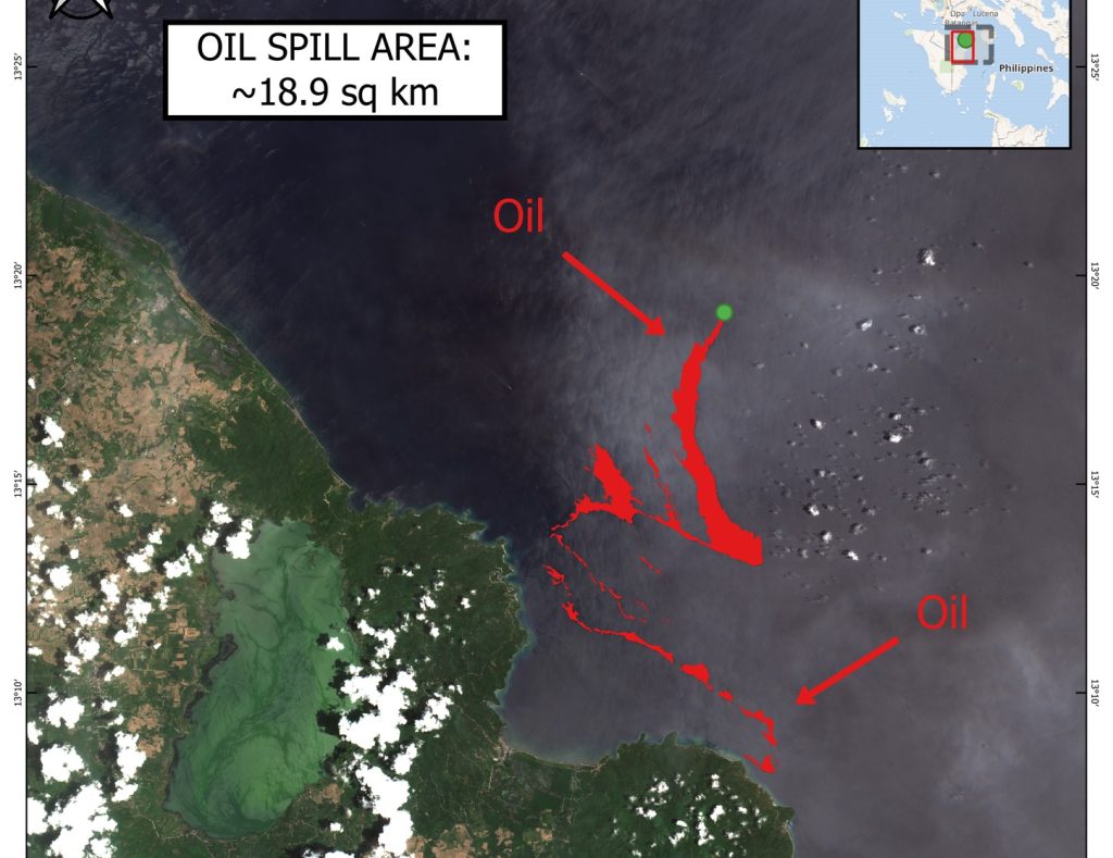
Oil spill from the sunken vessel off Naujan, Oriental Mindoro reached Tablas Strait in Oriental Mindoro, based on the latest satellite image from the Philippine Space Agency (PhilSA).

PhilSA’s satellite image taken from March 31 to April 2 showed a possible oil spill reaching Tablas Strait and Tayabas Bay in Oriental Mindoro.

Tablas Strait is a strait separating Mindoro Island from Panay and Romblon Islands, meanwhile, Tayabas Bay is bordered on the north and east side by Quezon Province.

According to PhilSA, the maps were processed from the images captured by the Copernicus European Union’s Sentinel-1 and Sentinel-2 satellites and retrieved from the International Charter Space and Major Disasters.

“The Disasters Charter is a worldwide collaboration of various space agencies and other space-related institutions through which satellite data are made available for the benefit of disaster management,” PhilSA said. – cf


Popular

PBBM credits First Lady for restoring PICC back to glory

By Brian Campued President Ferdinand R. Marcos Jr. has nothing but praise for his wife, First Lady Liza Marcos, for leading the efforts on the...

Palace: PBBM won’t meddle, interfere with ICI flood control probe

By Dean Aubrey Caratiquet At the Malacañang press briefing on Wednesday, Presidential Communications Office (PCO) Undersecretary and Palace Press Officer Claire Castro reaffirmed President Ferdinand...

Corruption ‘not typical’ of gov’t —PBBM

By Brian Campued “These corrupt people are not the face of government. All they are is the face of corruption. That’s all they are. They...

PBBM to local chief executives: Lead with grace, stem corruption at its roots

By Dean Aubrey Caratiquet At the oath-taking ceremony of the newly elected officials of the League of Cities of the Philippines (LCP) and the League...