
By Alec Go
Tropical Cyclone Wind Signal (TCWS) No. 1 has been hoisted over several areas in Luzon and Visayas on Tuesday morning, April 11, as Tropical Depression “Amang” accelerates towards Catanduanes coast.
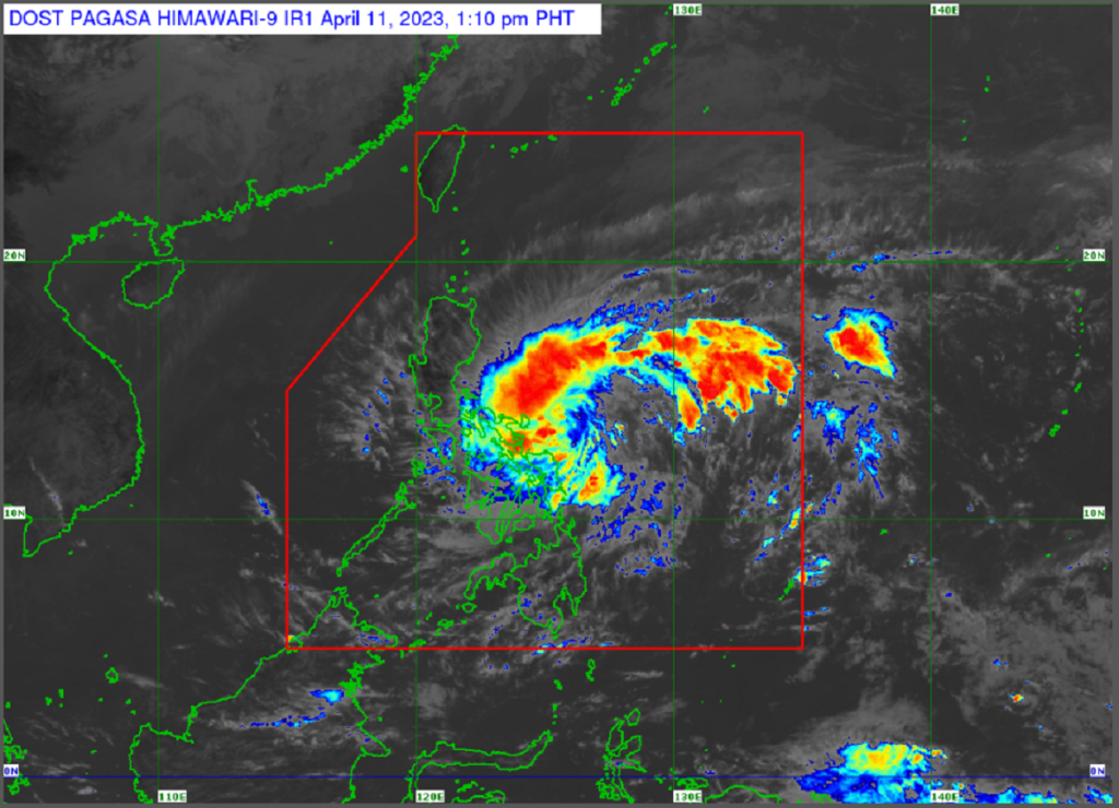
In the tropical cyclone bulletin of Philippine Atmospheric, Geophysical and Astronomical Services Administration (PAGASA), “Amang” was eyed 270 kilometers (km) east of Virac, Catanduanes.
It is moving with a maximum sustained winds of 55 km per hour (km/h) near the center and with gustiness of up to 70 km/h.
Here are the areas under TCWS No. 1 as of 11:00 a.m.:
Luzon
- Catanduanes
- Sorsogon
- Albay
- Camarines Sur
- Camarines Norte
- Marinduque
- Masbate including Ticao Island, Burias Island
- Quezon (Pitogo, San Andres, Buenavista, San Francisco, Calauag, Infanta, Lopez, Catanauan, Mulanay, Guinayangan, Unisan, General Luna, Plaridel, Quezon, Alabat, Sampaloc, Padre Burgos, Macalelon, Mauban, General Nakar, Perez, Agdangan, Gumaca, Atimonan, Real, San Narciso, Tagkawayan, Pagbilao, City of Tayabas) including Poliolo Islands
Visayas
- Eastern Samar
- Northern Samar
- Samar
- Biliran
Intense rains may prevail over Northern Samar and the northern portions of Samar and Eastern Samar, and heavy rains over the rest of Samar provinces until Tuesday night.
For Tuesday until Thursday evening, Bicol Region, Northern Samar, and the northern portions of Samar and Eastern Samar may experience intense rains.
The southern portion of Quezon and the rest of Samar provinces will also experience heavy rains.
Meanwhile, PAGASA said “Amang” is forecast to move towards the Bicol Region in the next 24 hours and will remain a tropical depression.
A landfall scenario has not yet been ruled out despite its current forecast track to remain. offshore over the water of eastern Luzon.
It may weaken into a low pressure area by late Thursday or early Friday.
A gale warning is in effect over the eastern seaboard of Catanduanes, the northern and eastern seaboards of Northern Samar, and over the eastern seaboard of Eastern Samar. – gb