
By Alec Go
Tropical Storm “Chedeng” has maintained its strength on Wednesday morning, June 7, but remains unlikely to directly bring heavy rainfall and far from the Philippine landmass, the weather bureau said.
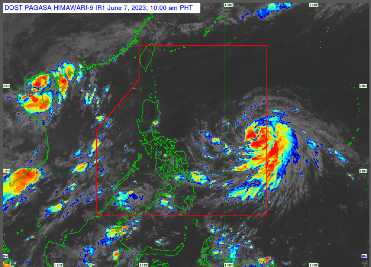
As of 10:00 a.m., the tropical storm is 1,190 kilometers (km) east of southeastern Luzon, with maximum sustained winds of 75 km/h near the center and gustiness of up to 90 km/h. It is headed northward at 10 km/h.
The Philippine Atmospheric, Geophysical and Astronomical Services Administration (PAGASA) raised the category of “Chedeng” from tropical depression to tropical storm late Tuesday night.
“Malayo pa ang sentro ng bagyong si ‘Chedeng’ sa anumang bahagi ng ating bansa. Yung malawak na ulap nito, malayo pa rin sa ilang bahagi ng ating bansa,” PAGASA Asst. Weather Services Chief Chris Perez said.
“Base sa ating latest forecast track, makikita nating hindi natin inaasahang magla-landfall itong bagyong si ‘Chedeng’,” he added.
The tropical storm is also unlikely to cause rough sea conditions over the coastal waters of the country in the next 24 hours. However, the southwest monsoon (habagat) may be enhanced by the tropical cyclone.
No warning signals are expected to be hoisted in any part of the country.