
By Dean Aubrey Caratiquet
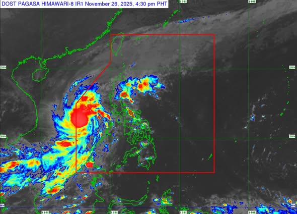
After undergoing rapid intensification on Tuesday, Severe Tropical Storm Verbena is now hovering within proximity of the Kalayaan Islands, according to PAGASA’s 5:00 p.m. weather bulletin.
Verbena was last located 230 km northeast of Pag-asa Island, Kalayaan, Palawan, packing maximum sustained winds of 95 kph near the center and gustiness of up to 115 kph, as it continues to move westward at 15 kph.
Tropical Cyclone Wind Signal (TCWS) No. 1 continues to prevail over Kalayaan Islands.
PAGASA, meanwhile, issued a gale warning advisory over the seaboards of Northern Luzon and the western seaboard of Southern Luzon, noting risky travel for all types of vessels due to very rough seas and high waves in these coastal waters:
- Up to 5.5 m: The seaboards of Batanes, Babuyan Islands, Ilocos Norte, and Ilocos Sur
- Up to 5.0 m: The seaboards of mainland Cagayan and Kalayaan Islands
- Up to 4.5 m: The remaining seaboards of Ilocos Region
The state weather bureau notes that Verbena will continue on its westward or west-northwestward trajectory over the West Philippine Sea until Thursday (Nov. 27) and may exit the Philippine Area of Responsibility on Wednesday night or Thursday morning.
After its PAR exit, Verbena may decelerate and change its trajectory on Friday (Nov. 28), but may further intensify as it continues to hover over the West Philippine Sea.
av