
By Dean Aubrey Caratiquet
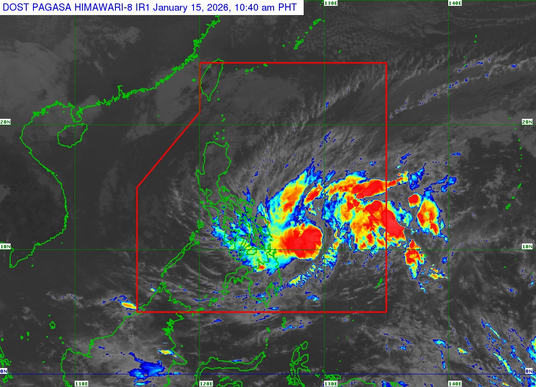
Tropical Depression Ada maintained its speed but increased in strength as it continues to hover over the Philippine Sea, according to the Philippine Atmospheric, Geophysical and Astronomical Services Administration’s (PAGASA) 11:00 a.m. bulletin.
Ada was last located 420 km east of Surigao City, Surigao del Norte, packing maximum sustained winds of 55 kph and gustiness of up to 70 kph, as it moves west northwestward at 10 kph.
Due to the tropical cyclone’s closer proximity to the Philippine landmass, Tropical Cyclone Wind Signal (TCWS) No. 1 is hoisted in the following areas, which are expected to experience strong winds over the next 36 hours:
- Sorsogon
- Catanduanes
- Albay
- Northern Samar
- Samar
- Eastern Samar
- Biliran
- Leyte
- Southern Leyte
- Dinagat Islands
- Surigao del Norte
- Surigao del Sur
While the state weather bureau is yet to issue any gale warning advisories, PAGASA advises fisherfolk and owners of small marine vessels against sailing due to rough seas over the following coastal waters:
• Up to 4.0 m: The northern and eastern seaboards of Catanduanes, Northern Samar, and Siargao-Bucas Grande Islands; the eastern seaboards of Albay, Sorsogon, Eastern Samar, Dinagat Islands, and Surigao del Sur.
• Up to 3.5 m: The seaboard of Camarines Norte; the northern seaboard of Camarines Sur; the eastern seaboard of Polillo Islands.
• Up to 3.0 m: The seaboard of Isabela, Aurora, and northern mainland Quezon; the eastern seaboard of mainland Cagayan and Davao Oriental; the northern seaboard of Polillo Islands.
Ada may reach tropical storm category Thursday, as it continues to gain strength over the Philippine Sea.
It is expected to pass near Eastern Samar and Northern Samar on Friday (Jan.16) or Saturday (Jan. 17) before heading towards east of Catanduanes, indicating a possible landfall over Eastern Visayas and Bicol Region over the next few days.
jpv