
By Brian Campued
Tropical Storm Ada (international name: Nokaen) continues to threaten the eastern section of the country as it moves over the sea east of Bicol Region, the state weather bureau said Saturday.
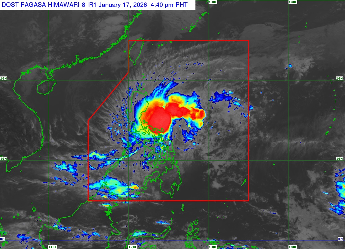
As of 4:00 p.m., the Philippine Atmospheric, Geophysical and Astronomical Services Administration (PAGASA) said the center of Tropical Storm Ada was located over the coastal waters of Pandan, Catanduanes.
Ada packs maximum sustained winds of 85 kph and gustiness of up to 105 kph, while moving north-northwestward at 10 kph.
In its 5:00 p.m. bulletin, PAGASA said Tropical Cyclone Wind Signal (TCWS) No. 2 was hoisted in parts of Bicol Region:
- Eastern portion of Camarines Norte (Vinzons, San Lorenzo Ruiz, San Vicente, Talisay, Basud, Mercedes, Daet, and Paracale)
- Eastern and central portions of Camarines Sur (Siruma, Tinambac, Ocampo, Goa, Lagonoy, Milaor, Nabua, Buhi, Caramoan, Baao, Cabusao, Bato, Camaligan, Pili, Sipocot, Tigaon, Pamplona, Garchitorena, Iriga City, San Fernando, Magarao, Minalabac, Balatan, Libmanan, Naga City, Calabanga, Bombon, Bula, Canaman, Pasacao, Sagñay, San Jose, Presentacion, Gainza, and Lupi)
- Albay
- Catanduanes
Areas under TCWS No. 2 may experience gale-force winds from 62 to 88 kph within the next 24 hours, which may cause minor to moderate damage to life and property.
Meanwhile, strong winds between 39 to 61 kph may be expected within the next 36 hours in the following areas under Wind Signal No. 1:
- Southeastern portion of Isabela (Dinapigue and Palanan)
- Aurora
- Eastern portion of Quezon (Tagkawayan, Guinayangan, Lopez, Calauag, Buenavista, San Narciso, San Andres, San Francisco, Mulanay, Catanauan, General Luna, Macalelon, Gumaca, Pitogo, Unisan, Atimonan, Plaridel, Agdangan, Padre Burgos, Quezon, Alabat, Perez, General Nakar, Infanta, Real, and Mauban) including Polillo Islands
- Marinduque
- Eastern portion of Romblon (Cajidiocan, Magdiwang, and San Fernando)
- Rest of Camarines Norte
- Rest of Camarines Sur
- Sorsogon
- Masbate
- Northern Samar
- Northern and central portions of Eastern Samar (Can-Avid, Maslog, City of Borongan, San Policarpo, Taft, Dolores, Jipapad, Oras, Arteche, Sulat, and San Julian)
- Northern and central portions of Samar (San Jorge, San Sebastian, Villareal, Zumarraga, Matuguinao, Pinabacdao, Almagro, Calbayog City, Talalora, Jiabong, Pagsanghan, City of Catbalogan, Gandara, Motiong, Santo Niño, Tagapul-An, San Jose de Buan, Santa Margarita, Tarangnan, Calbiga, Daram, Paranas, and Hinabangan)
- Biliran
Heavy to intense rains will drench Catanduanes and Camarines Sur until Sunday afternoon, Jan. 18, while moderate to heavy rains are likely in Quezon, Camarines Norte, Albay, Sorsogon, and Northern Samar.
Flooding and landslides remain possible in the said areas.
The state weather bureau also warned of a “minimal to moderate risk” of storm surge of up to 2 meters within the next 48 hours, affecting coastal communities in Quezon, Camarines Norte, Camarines Sur, Catanduanes, Albay, Sorsogon, Masbate, Northern Samar, Eastern Samar, Samar, and Biliran.
Residents in the said areas are advised to stay away from the coast, cancel all marine activities, and move to higher ground.
Mariners of small seacrafts are likewise urged to avoid sea travel due to stormy conditions affecting the northern coast of Camarines Sur, northern and eastern coasts of Catanduanes, as well as the seaboards of Polillo Islands and Camarines Norte.
According to PAGASA, Ada is forecast to remain as a tropical storm while traversing the sea east of Luzon.
“Ada will move generally northwestward today before slowly turning northward to northeastward tomorrow (18 January),” it said, noting that a westward shift may result in a possible landfall over Catanduanes.
“From tomorrow onwards, Ada is forecast to follow a looping track over the sea east of Luzon.”
-jpv