
By Dean Aubrey Caratiquet
After entering the Philippine area of responsibility (PAR) late Saturday, Tropical Storm Hagupit was assigned the domestic name “Caloy.”
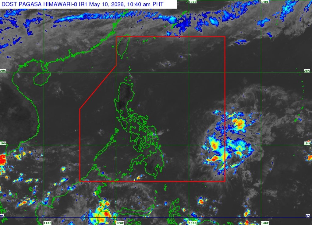
Now, the weather system has weakened into a Tropical Depression as it continues to move over the waters east of northeastern Mindanao, according to PAGASA’s 11:00 a.m. bulletin.
Caloy was last located 770 km east of Surigao City, Surigao del Norte, packing maximum sustained winds of 55 kph and gustiness of up to 70 kph as it moves northwestward at 10 kph.
While it is expected to not have any direct effect on Philippine weather, the trough of Caloy may bring light to moderate rains over Eastern Visayas and parts of Caraga region.
While the state weather bureau has not issued any gale warning advisory, the agency warned of moderate seas over the following coastal waters:
• Up to 2.5 m: The eastern seaboards of Northern Samar, Eastern Samar, and Siargao-Bucas Grande Islands; the seaboards of Batanes.
• Up to 2.0 m: The remaining seaboards of Ilocos Norte and Babuyan Islands; the eastern seaboards of Cagayan, Isabela, Camarines Norte, Catanduanes, Albay, Sorsogon, Dinagat Islands, Surigao del Sur, and Davao Oriental; the northern seaboards of Camarines Sur, Catanduanes, and Northern Samar; the western seaboard of Babuyan Islands; and the northwestern seaboard of Ilocos Norte.
Caloy is expected to continue moving west-northwestward over the Philippine Sea, far from the Philippine landmass, and is expected to further weaken on Monday.
Meanwhile, PAGASA has monitored another low pressure area hovering outside PAR, which was last located 2,355 km east of northeastern Mindanao and is unlikely to develop into a weather system over the next few days.
av