
By Brian Jules Campued
Typhoon Aghon (international name Ewiniar) has maintained its strength while moving northeastward over the Philippine Sea, the Philippine Atmospheric, Geophysical and Astronomical Services Administration (PAGASA) said Monday.
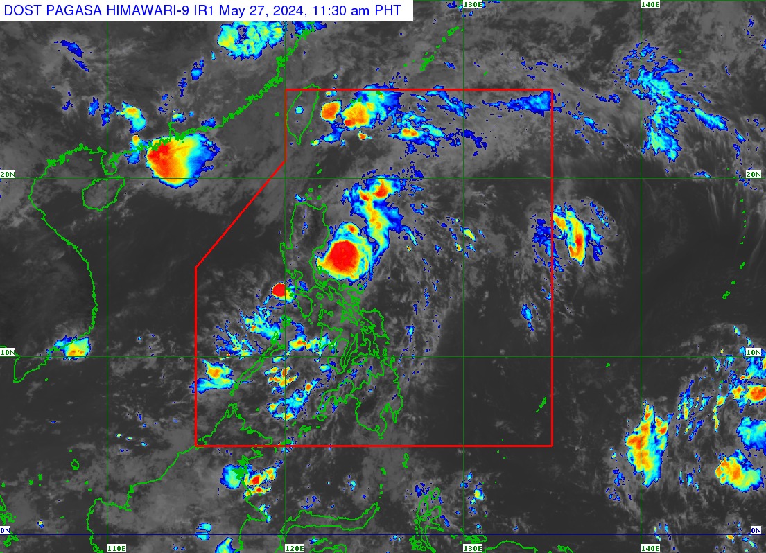
In its Tropical Cyclone Bulletin issued 11 a.m., PAGASA said the eye of Aghon was spotted 100 kilometers east southeast of Casiguran, Aurora.
It packs maximum sustained winds of 140 kilometers per hour and gustiness of up to 170 kph, while slowly moving northeastward at 10 kph.
Tropical Cyclone Wind Signal (TCWS) Nos. 2 and 1 remain in effect over six provinces in Luzon:
Signal No. 2
- Southeastern portion of Isabela (Dinapigue, Palanan)
- Northern portion of Aurora (Dilasag, Casiguran)
Signal No. 1
- Northeastern and southern portions of Isabela (Divilacan, San Mariano, San Guillermo, Jones, Echague, San Agustin, Ilagan City, Benito Soliven, City of Cauayan, Maconacon, Angadanan, Naguilian)
- Eastern portion of Quirino (Maddela, Nagtipunan, Aglipay)
- Southern portion of Nueva Vizcaya (Alfonso Castañeda)
- Rest of Aurora
- Northern portion of Quezon (General Nakar, Infanta, Real) including Polillo Islands
- Northwestern portion of Camarines Norte (Paracale, Jose Panganiban, Vinzons, Capalonga) including Calaguas Islands
The state weather bureau also warned mariners of small crafts and motor bancas to avoid navigation over the coastal waters of southern Cagayan, Isabela, Aurora, and the northern portion of Quezon including Polillo Islands as a Gale Warning is still hoisted in the said areas.
While the typhoon is less likely to directly affect the country within the next three days, it enhances the southwesterly wind flow as it moves away from the Philippine landmass—bringing rains over Cavite, Batangas, Bataan, Mimaropa, and Western Visayas.
“Ine-expect natin na habang umaangat ang bagyo na ito ay magpapatuloy ang mga epekto ng mga pag-ulan sa mga nabanggit na lugar sa susunod na dalawa hanggang tatlong araw,” PAGASA weather specialist Benison Estareja said.
“Afterwards ay lalabas na po ito (Typhoon Aghon) ng PAR Wednesday (May 29) ng tanghali or ng hapon,” Estareja added.
However, Cagayan Valley, Aurora, Polillo Islands, and the northern portion of Camarines Norte may still experience strong winds due to Aghon.
Meanwhile, the southwesterly wind flow would bring light to moderate with at times heavy rains over Occidental Mindoro, Palawan, Antique, Iloilo, Guimaras, and Negros Occidental on Monday.
By Tuesday (May 28), Estareja said that Occidental Mindoro, Palawan, and Eastern Visayas are likely to experience light to moderate with at times heavy rains, still due to the southwesterly wind flow. – iro