By Brian Campued
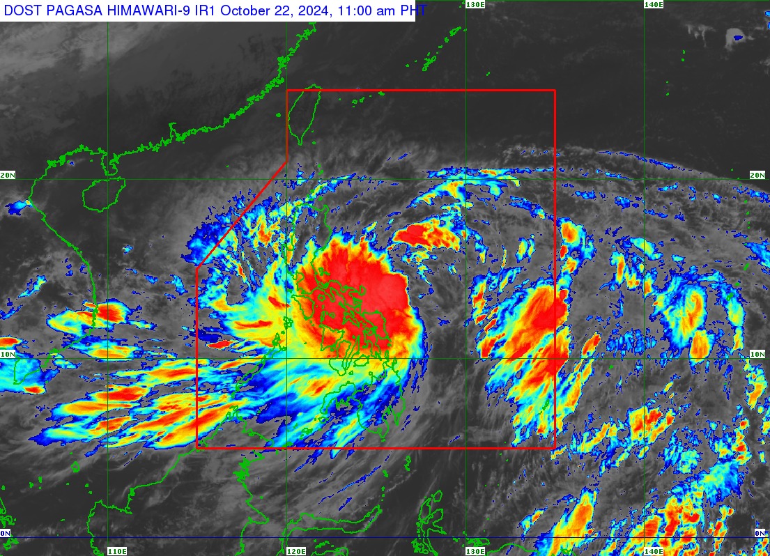
The province of Catanduanes has been placed under Tropical Cyclone Wind Signal (TCWS) No. 2 as “Kristine” intensifies into a tropical storm over the Philippine Sea on Tuesday, the state weather bureau said.
In its tropical cyclone bulletin issued at 11:00 a.m., the Philippine Atmospheric, Geophysical and Astronomical Services Administration (PAGASA) said Kristine was located 335 kilometers east of Virac, Catanduanes, moving west-northwestward at 10 kilometers per hour.
The tropical storm packs maximum sustained winds of 65 kph at gustiness of up to 80 kph.
Due to this, PAGASA hoisted TCWS No. 1 over the following areas across the country:
Luzon
- Ilocos Norte
- Ilocos Sur
- La Union
- Pangasinan
- Apayao
- Kalinga
- Abra
- Mountain Province
- Ifugao
- Benguet
- Cagayan including Babuyan Islands
- Isabela
- Quirino
- Nueva Vizcaya
- Aurora
- Nueva Ecija
- Tarlac
- Zambales
- Bataan
- Pampanga
- Bulacan
- Metro Manila
- Cavite
- Laguna
- Batangas
- Rizal
- Quezon including Polillo Islands
- Masbate including Ticao Island
- Burias Island
- Marinduque
- Romblon
- Camarines Norte
- Camarines Sur
- Albay
- Sorsogon
Visayas
- Eastern Samar
- Northern Samar
- Samar
- Leyte
- Biliran
- Southern Leyte
Mindanao
- Dinagat Islands
- Surigao del Norte including Siargao – Bucas Grande Group
Strong to gale-force gusts are also expected today in Batanes, Babuyan Islands, Ilocos Region, Palawan, Romblon, Aklan, Antique, Negros Island Region, Central Visayas, Southern Leyte, Zamboanga del Norte, Northern Mindanao, Dinagat Islands, Surigao del Norte, Agusan del Norte, Sarangani, Davao del Sur, and Davao Oriental.
In terms of rainfall, the state weather bureau said intense to torrential rains are expected in Catanduanes, Camarines Norte, Camarines Sur, Albay, Sorsogon, and Northern Samar until Wednesday noon.
Heavy to intense rains are, likewise, forecast in Masbate, Samar, Eastern Samar, Isabela, and Quezon, while moderate to heavy rains are likely to be experienced over the rest of Cagayan Valley, Cordillera Administrative Region, Aurora, Nueva Ecija, Romblon, Marinduque, and the rest of Visayas.
“Under these conditions, flooding and rain-induced landslides are likely, especially in areas that are highly or very highly susceptible to these hazards as identified in hazard maps and in areas with significant antecedent rainfall,” PAGASA said.
PAGASA also warned of “moderate to high risk” threat of storm surge in the next 48 hours over low-lying, coastal localities of Catanduanes, Camarines Sur, Albay, Aurora, Isabela, and Cagayan.
Meanwhile, the agency also cautioned against sea travel as a gale warning is hoisted over the eastern seaboard of Luzon, the southern seaboard of Southern Luzon, and the eastern seaboard of Visayas.
In its track forecast, Kristine will continue to intensify and become a severe tropical storm before making landfall over Isabela or northern Aurora between Wednesday evening (Oct. 23) or Thursday morning (Oct. 24).
It will traverse Northern Luzon and emerge over the West Philippine Sea where it may intensify into a typhoon before exiting the Philippine Area of Responsibility (PAR) on Friday (Oct. 25).
“Changes in forecast track are not ruled out, depending on the movement of the weather systems surrounding this tropical cyclone in the next few days,” PAGASA said. —iro
