
By Christine Fabro
Typhoon “Chedeng” continues to weaken as it accelerates away from the Philippine landmass, the state weather bureau reported Sunday morning, June 11.
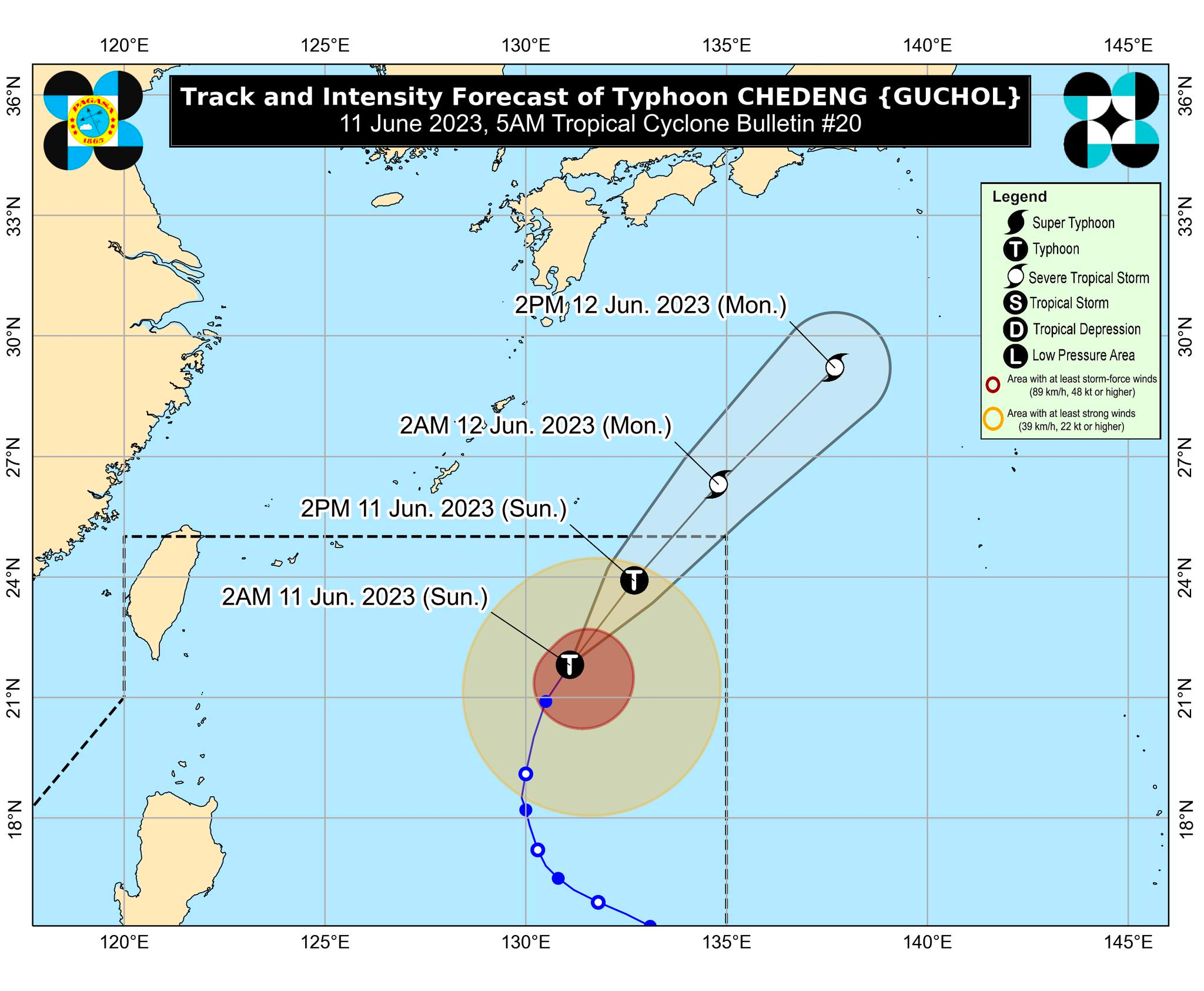
“Chedeng” was last located at 990 kilometers (km) east of Extreme Northern Luzon with maximum sustained winds of 130 km per hour (kph) near the center and gustiness of up to 160 kph.
The Philippine Atmospheric, Geophysical and Astronomical Services Administration (PAGASA) said “Chedeng” is unlikely to bring heavy rainfall over the country in the next three days.
However, it will enhance the southwest monsoon (habagat) bringing occasional to monsoon rains over the western portions of Luzon and Visayas in the next three days.
PAGASA Weather Specialist Grace Castañeda said “Chedeng” is forecast to leave the Philippine area of responsibility on Sunday night, June 11, or Monday early morning, June 12.
“Patuloy na bibilis ang pagkilos ni Bagyong Chedeng pahilagang-silangan, mas palayo pa ‘yan dito sa ating kalupaan at posible itong lumabas ng ating area of responsibility mamayang gabi o bukas ng early morning,” Catañeda reported.
“Chedeng” is also forecast to be downgraded into a severe tropical storm within Sunday or Monday early morning.
“Habagat” will bring monsoon rains over Zambales and Bataan, and will cause cloudy skies with scattered rain showers and thunderstorms over Metro Manila, Ilocos Region, Calabarzon, Abra, Benguet, Palawan, Occidental Mindoro, Antique, and the rest of Central Luzon.
The rest of the country will experience partly cloudy to cloudy skies with isolated rain showers or thunderstorms due to “habagat” or localized thunderstorms.