
By Dean Aubrey Caratiquet
After its initial intensification into a supertyphoon, Typhoon Francisco (international name: Mekkhala) weakened further into a severe tropical storm early Thursday, according to PAGASA’s 11:00 a.m. bulletin.
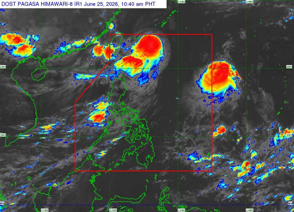
Francisco was last located 455 km northeast of Itbayat, Batanes, packing maximum sustained winds of 100 kph and gustiness of up to 125 kph as it moves north northeastward at 15 kph.
The state weather bureau has lifted all Tropical Cyclone Wind Signals that were earlier issued in some places in Northern Luzon as the weather system continues to drift away from the Philippine landmass.
Likewise, PAGASA has not issued any gale warning advisory, but warns owners of small vessels of rough seas over the seaboard of Batanes, which may experience waves up to 3.0 meters high.
According to the state weather bureau, Francisco is expected to remain on track as it heads towards the Ryukyu Islands, but may further weaken to a tropical storm before exiting the Philippine area of responsibility (PAR) on Thursday afternoon or evening.
Meanwhile, the state weather bureau continues to monitor Tropical Storm Higos (to be called ‘Gardo’ upon PAR entry), which was last located 1,760 km east of Central Luzon—packing maximum sustained winds of 75 kph and gustiness of up to 90 kph as it moves west northwestward at 20 kph.
Weather Specialist John Manalo noted that ‘Gardo’ will only pass along the upper right corner of the PAR) before exiting shortly afterwards, and will have a negligible effect on the country’s weather.
jpv