
By Alec Go
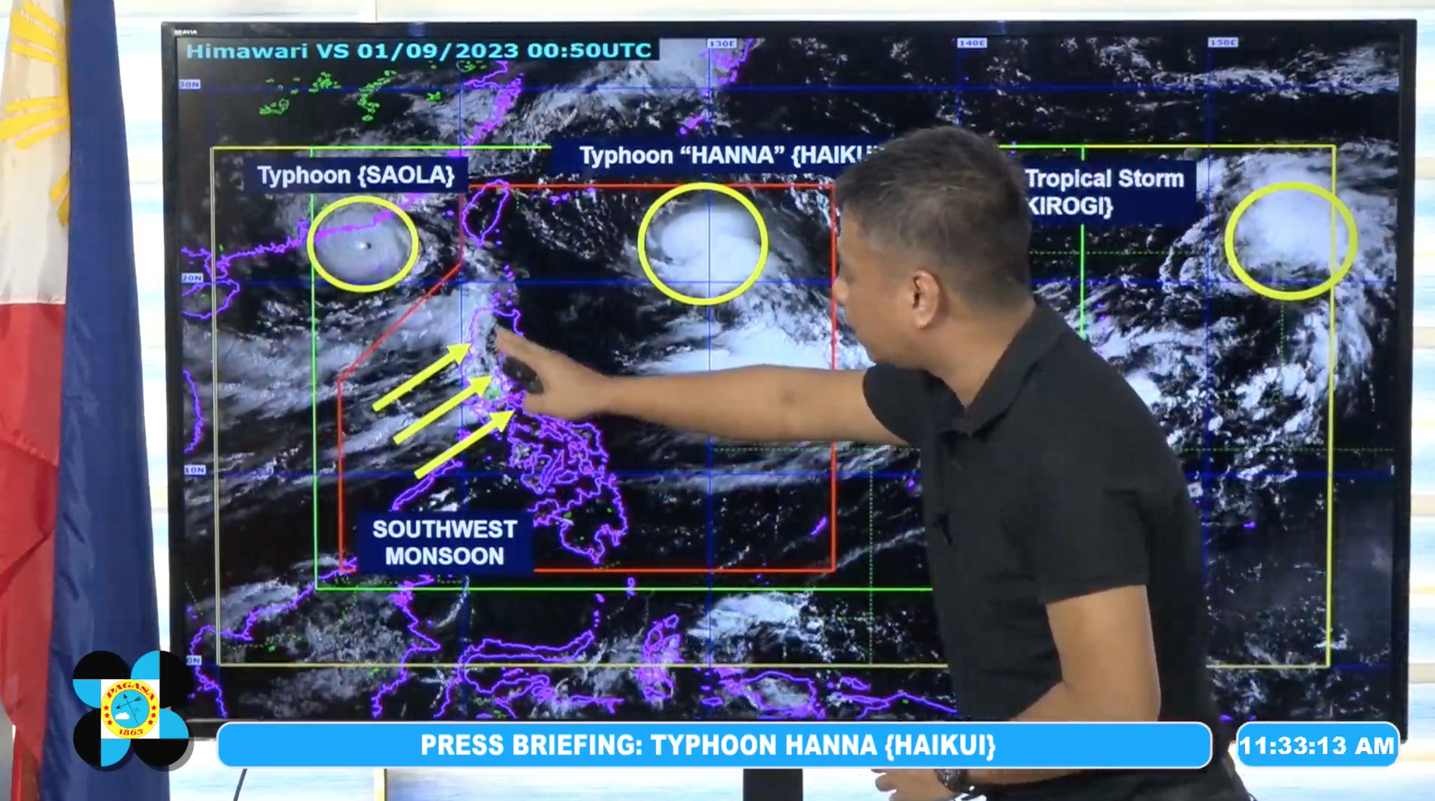
Severe Tropical Storm “Hanna” has intensified into a typhoon, while the enhanced southwest monsoon or habagat will continue to bring rains over portions of the country in the next three days, the state weather bureau said Friday, Sept. 1.
As of 10:00 a.m., “Hanna” was at 785 kilometers (km) east northeast of Itbayat, Batanes, moving westward at 20 km/h with maximum sustained winds of 120 km/h near the center, and gustiness of up to 150 km/h.
The Philippine Atmospheric, Geophysical and Astronomical Services Administration (PAGASA) said in its 11:00 a.m. bulletin that the typhoon “is less likely to directly bring heavy rainfall over the country.”
However, Typhoon “Hanna”, along with Typhoon “Saola” (formerly “Goring”) and Severe Tropical Storm Kirogi are currently enhancing habagat.
Based on its outlook, PAGASA said the following areas may experience heavy rainfall in the next three days:
Sept. 1
50-100mm: Ilocos Region, Abra, Benguet, Tarlac, Nueva Ecija, Pampanga, Bulacan, Rizal, Cavite, and Batangas
100-200mm: Metro Manila, Zambales, Bataan, and Occidental Mindoro
Sept. 2
50-100mm: Abra, Benguet, Tarlac, Nueva Ecija, Pampanga, Bulacan, Rizal, Cavite, and Batangas
100-200mm: Metro Manila, Ilocos Region, Zambales, Bataan, and Occidental Mindoro
Sept. 3
50-100mm: Abra, Benguet, Tarlac, Nueva Ecija, Pampanga, Bulacan, Rizal, Cavite, Batangas, Northern Palawan including Cuyo and Calamian Islands, and Antique
100-200mm: Metro Manila, Ilocos Region, Zambales, Bataan, and Occidental Mindoro
PAGASA said a gale warning is in effect for most seaboards of Luzon and Western Visayas, and the seaboard of Northern Samar.
“Hanna” may exit the Philippine Area of Responsibility on Sunday morning.