By Brian Campued
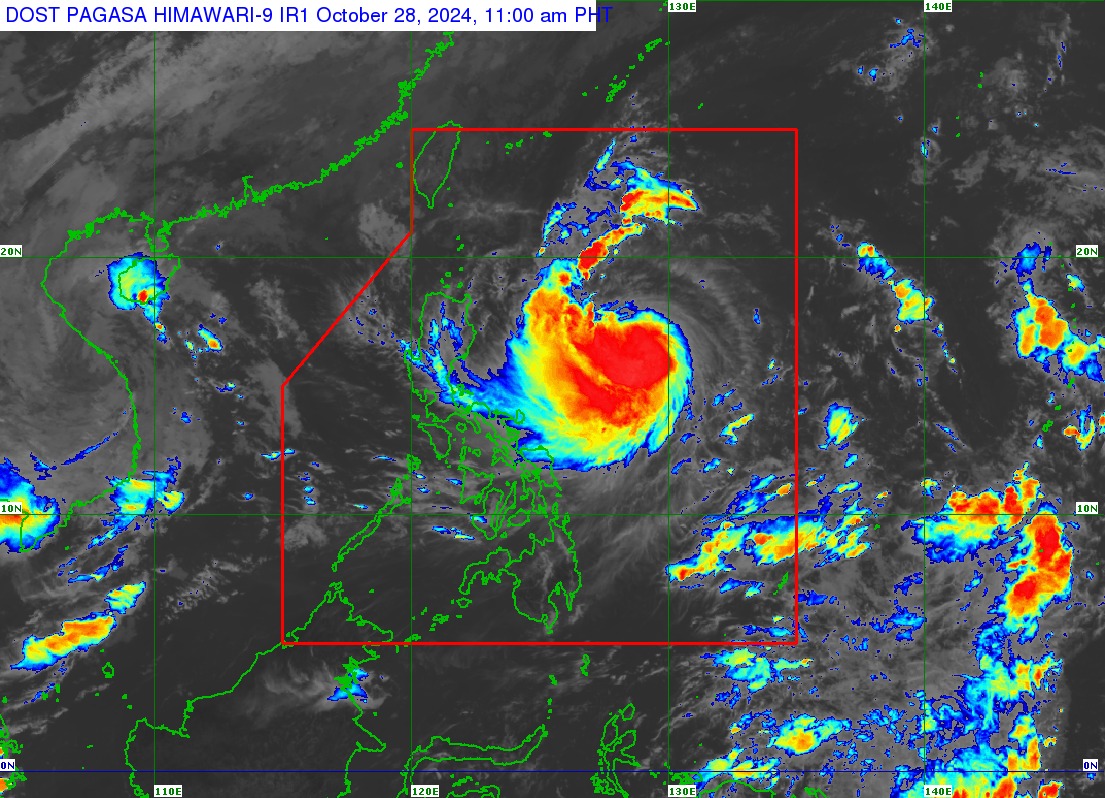
Tropical Storm Leon (international name: Kong-rey) has intensified into a severe tropical storm Monday morning, the state weather bureau said.
In its tropical cyclone bulletin issued at 11:00 a.m., the Philippine Atmospheric, Geophysical and Astronomical Services Administration (PAGASA) said the eye of “Leon” was located at 735 kilometers (km) east of Casiguran, Aurora or 780 km east of Echague, Isabela.
Leon is moving westward at 20 kilometers per hour (kph), with winds of 95 kph and gusts of up to 115 kph.
PAGASA said Leon may rapidly intensify into a typhoon within 24 hours, while moving northwestward and remaining offshore until it makes landfall over the eastern coast of Taiwan on Thursday (Oct. 31) or Friday (Nov. 1).
However, PAGASA Weather Division officer-in-charge, Engr. Chris Perez said that Leon’s cone of probability along its forecast track shows a possible landfall scenario in the Batanes Group of Islands or Babuyan Group of Islands.
“Makikita natin sa forecast track na ang bagyo ay posible ngang maging typhoon bago tuluyang lumapit dito sa may bandang dulong-hilagang Luzon at maaaring kumilos nang may kalapitan—pass closely over the Batanes area sa darating na Miyekroles o Huwebes,” Perez said.
Leon may exit the Philippine Area of Responsibility (PAR) Friday morning or afternoon.
Several areas in northern and eastern portions of Luzon have been placed under Tropical Cyclone Wind Signal (TCWS) No. 1 due to expected strong winds brought by Severe Tropical Storm Leon:
- Batanes
- Cagayan including Babuyan Islands
- Isabela
- Ilocos Norte
- Abra
- Apayao
- Kalinga
- Eastern portion of Mountain Province (Natonin, Paracelis)
- Eastern portion of Ifugao (Aguinaldo, Alfonso Lista)
- Eastern portion of Quirino (Maddela)
- Northern portion of Aurora (Dilasag, Casiguran, Dinalungan)
- Northern portion of Catanduanes (Pandan, Bagamanoc, Panganiban, Viga, Gigmoto)
In terms of rainfall, Leon will cause heavy to intense rainfall over Antique, while moderate to heavy rains in Cagayan including Babuyan Islands, Occidental Mindoro, Negros Occidental, and Palawan until Tuesday noon (Oct. 29).
“Generally habang lumalapit ang bagyo, hindi lamang ’yung mga lugar sa northern at eastern sections ng Luzon ang puwedeng ulanin. Mapapansin natin na may mga lugar din dito sa western section ng southern Luzon at maging sa western part ng Visayas ang puwedeng ulanin sa mga susunod na araw,” Perez explained.
Strong to gale-force winds are also forecast today in Batangas, most of Mimaropa, most of Bicol Region, Visayas, most of Northern Mindanao, and most of Caraga Region.
While forecast data shows that Leon will not make landfall in any parts of the country, PAGASA Administrator Dr. Nathaniel Servando reminded the public to stay updated and alert especially ahead of the “Undas” weekend when people are expected to travel to their provinces.
“Pinapayuhan natin [ang ating mga kababayan] na maging alerto, maghanda, [at] mag-ingat kung sila ay magbibiyahe dahil inaasahan natin sa mga susunod na araw, ang Bagyong Leon ay, kung hindi magbago ng kaniyang direksiyon, ay makaapekto ito sa Northern Luzon,” Servando said.
The state weather bureau also advised the public to visit the tombs of their loved ones before Nov. 1 (All Saints’ Day) as rains are forecast while Leon approaches Northern Luzon.
—avds
