By Dean Aubrey Caratiquet
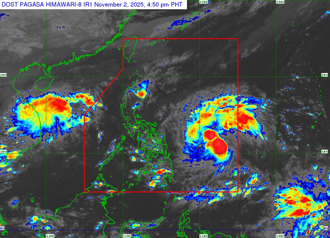
Severe Tropical Storm Tino continues to intensify as it continues to move over the Philippine Sea and approach the Southeast Asian nation’s landmass, according to the Philippine Atmospheric, Geophysical, and Astronomical Services Administration’s (PAGASA) 5:00 p.m. bulletin.
Tino (international name: Kalmaegi) was last located 805 km east of Eastern Visayas, packing maximum sustained winds of 95 kph near the center and gustiness of up to 115 kph, as it moves westward at 30 kph.
Due to the weather system’s intensification and closer proximity to the Philippine landmass, PAGASA has already hoisted Tropical Cyclone Wind Signal (TCWS) No. 1 in Eastern Samar, Northern Samar, Samar, Biliran, Leyte, Southern Leyte, Camotes Islands, Dinagat Islands, and Surigao del Norte.
The state weather bureau likewise cautioned owners of small marine seacraft against sailing in the following coastal waters due to very rough or high seas, irrespective of a gale warning advisory:
• Up to 7.0 m: The seaboard of Eastern Samar
• Up to 6.0 m: The northern and eastern seaboards of Siargao and Bucas Grande Islands.
• Up to 4.5 m: The eastern seaboard of Northern Samar
PAGASA, meanwhile, noted that Tino may make its initial landfall over Eastern Samar or Dinagat Islands on Monday evening (Nov. 3) or Tuesday morning (Nov. 4), traversing Visayas and Northern Palawan before emerging on the West Philippine Sea on Wednesday (Nov. 5).
While in the Philippine Sea, the weather system will continue to intensify and may reach typhoon category in the next 24 hours.
The state weather bureau advises the public and disaster risk reduction and management offices to take all precautionary measures to protect their constituents, especially those living in flood or landslide prone areas.
av
