By Brian Campued
Tropical Depression Wilma slowed down while over the Philippine Sea, based on the state weather bureau’s 5:00 p.m. bulletin on Thursday.
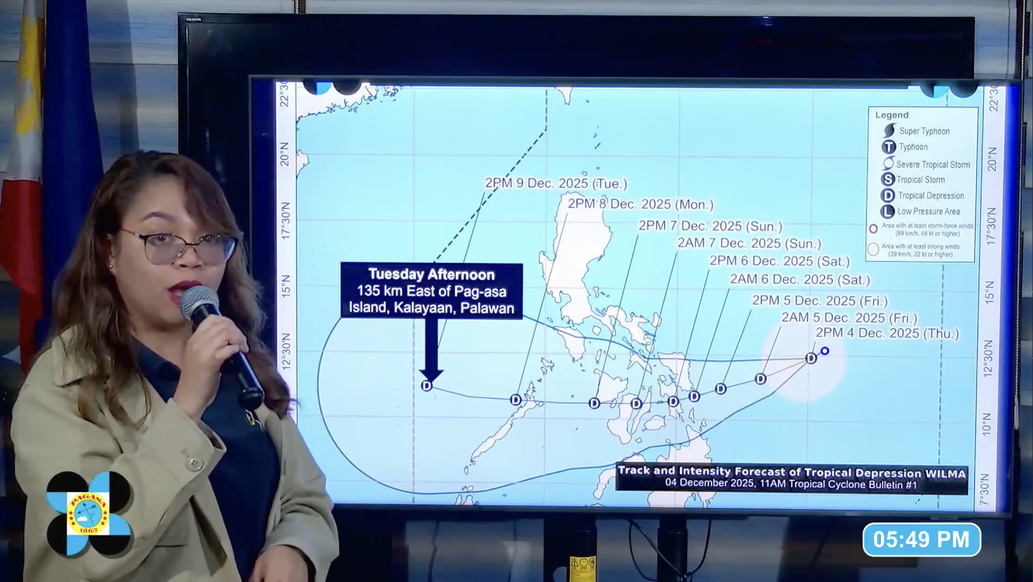
As of 4:00 p.m., Wilma’s center was located 575 km east of Catarman, Northern Samar, and is now moving west-southwestward at 10 kph. It packs maximum sustained winds of 45 kph and gustiness of up to 55 kph.
The Philippine Atmospheric, Geophysical and Astronomical Services Administration (PAGASA) has placed several provinces in Eastern Visayas, Central Visayas, and Caraga under Tropical Cyclone Wind Signal (TCWS) No. 1 due to possible strong winds brought by Wilma within the next 36 hours.
The areas under TCWS No. 1 are the following:
- Southern portion of mainland Masbate (Cataingan, Pio V. Corpuz, Esperanza, and Placer)
- Northern Samar
- Eastern Samar
- Samar
- Biliran
- Leyte
- Southern Leyte
- Northern portion of Cebu (Daanbantayan, Medellin, Bogo City, San Remigio, Tabogon, Borbon, Tabuelan, Tuburan, Sogod, Catmon, Asturias, Carmen, Danao City, Balamban, Compostela, Liloan, Consolacion, Cebu City, Mandaue City, Cordova, and Lapu-Lapu City), including Bantayan and Camotes Islands
- Eastern and central portions of Bohol (Inabanga, Sagbayan, Carmen, Garcia Hernandez, Jagna, Sierra Bullones, Pilar, Duero, Guindulman, Anda, Candijay, Mabini, Alicia, Ubay, Pres. Carlos P. Garcia, San Miguel, Dagohoy, Danao, Buenavista, Getafe, Trinidad, Talibon, Bien, and Unido)
- Surigao del Norte, including Siargao and Bucas Grande Islands
- Dinagat Islands
- Northern portion of Surigao del Sur (Carrascal, Cantilan, Madrid, and Carmen)
- Northern portion of Agusan del Norte (Kitcharao, Jabonga, Santiago, Tubay, and Cabadbaran City)
Due to the combined effects of Wilma and the shear line, heavy to intense rains are likely to occur in Northern Samar, Eastern Samar, Samar, Biliran, Catanduanes, Albay, and Sorsogon until Friday afternoon (Dec. 5).
Moderate to heavy rains are also forecast over Leyte, Southern Leyte, Cebu, Bohol, Negros Oriental, Negros Occidental, Siquijor, Surigao del Norte, Dinagat Islands, Agusan del Norte, Misamis Oriental, Camiguin, Camarines Sur, and Masbate during the same period.
PAGASA weather specialist Charmagne Varilla said Wilma may make landfall in Eastern Visayas or Dinagat Islands between late Friday (Dec. 5) or early Saturday (Dec. 6).
“Medyo may katagalan ‘yung pananatili niya (Bagyong Wilma) dito sa loob ng ating Philippine area of responsibility kaya mag-ingat po ‘yung ating mga kababayan dahil ‘yung mga malalakas at mga prolonged rains po… asahan po natin na maaaring magdulot ‘yan ng mga malawakang pagbaha at pagguho ng lupa,” Varilla said.
Gale warning remains in effect over the eastern seaboards of southern Luzon and Visayas, northern and eastern seaboards of Luzon, and the northern and western seaboards of northern Luzon.
The state meteorologist also urged the public to check the level of susceptibility of their localities to floods and landslides through HazardHunterPH.
-av
