
Tropical storm “Pepito” is expected to make its landfall over Aurora or Isabela between 7:00 to 11:00 PM, Tuesday.
According to the Philippine Atmospheric, Geophysical and Astronomical Services Administration (PAGASA), the tropical cyclone’s center was found 295 kilometers east of Baler, Aurora at 10:00 AM, Tuesday. It is moving northwestward at 25 km per hour with maximum sustained winds of 65 kph and gustiness of up to 80 kph.
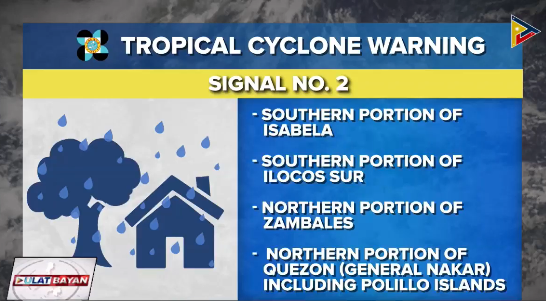
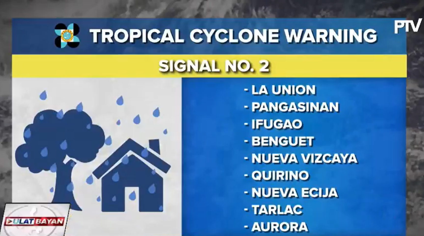
Signal number 2 has been raised over Pangasinan, Ifugao, Quirino, Nueva Ecija, Tarlac, La Union, Aurora, Nueva Vizcaya, the southern portion of Ilocos Sur, the northern portion of Zambales, the southern portion of Isabela, and the northern portion of Quezon.
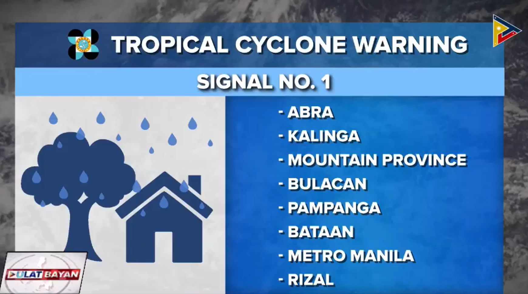
Signal number 1 has been hoisted over Metro Manila, Kalinga, Bulacan, Bataan, Catanduanes, Abra, Mountain Province, Rizal, the northern portion of Camarines Norte, Catanduanes, the northern portion of Quezon (Infanta and Real), and several parts of Ilocos Sur, Isabela, and Zambales.
The PAGASA has also issued a heavy rainfall warning in several areas. Red warning level in Camarines Norte and Yellow warning level in Northern Palawan. Fishing has been prohibited in Batanes, Cagayan, and Ilocos Norte given the gail warning.
“Pepito” is expected to leave the Philippine Area of Responsibility (PAR) on Friday.
Meanwhile, the National Disaster Risk Reduction and Management Council (NDRRMC) has alerted local government units (LGUs) that will be affected by the tropical storm.
According to NDRRMC Spokesperson Mark Timbal, LGUs have already been told to prepare and monitor areas prone to flooding and landslide. The observance of minimum health standards has also been strictly reiterated. – Report from Bea Bernardo