
By Brian Campued
The Philippine Atmospheric, Geophysical and Astronomical Services Administration (PAGASA) on Tuesday hoisted Tropical Cyclone Wind Signal (TCWS) No. 2 in some portions of Cagayan and Isabela due to Typhoon Ofel (international name: Usagi).
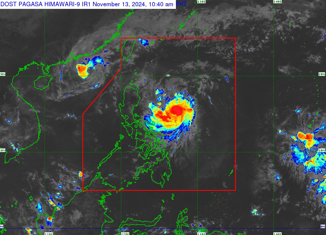
As of 10:00 a.m., the eye of “Ofel” was located 485 kilometers east-northeast of Daet, Camarines Norte, moving west-northwestward at 20 kilometers per hour.
The typhoon packs maximum sustained winds of 120 kph near the center and gustiness of up to 150 kph.
Based on PAGASA’s track forecast, Ofel is expected to make landfall at peak intensity along the eastern coast of Cagayan and Isabela Thursday morning (Nov. 14) before emerging over the Luzon Strait Friday (Nov. 15).
The state weather bureau warned that “hazards on land and coastal waters may still be experienced in areas outside the landfall point or forecast confidence cone.”
TCWS No. 2 is raised in the following areas:
- Eastern portion of mainland Cagayan (Baggao, Peñablanca, Gattaran, Gonzaga, Lal-lo, Santa Ana)
- Eastern portion of Isabela (Maconacon, Divilacan, Palanan)
Parts of Northern Luzon are likewise placed under TCWS No. 1:
- Batanes
- Cagayan (including Babuyan Islands)
- Rest of Isabela
- Quirino
- Nueva Vizcaya
- Apayao
- Kalinga
- Abra
- Mountain Province
- Eastern portion of Ifugao (Dilasag, Casiguran)
- Ilocos Norte
- Northern portion of Aurora (Alfonso Lista, Aguinaldo, Banaue, Mayoyao, Hingyon, Hungduan)
According to PAGASA, the highest wind signal which may be hoisted during the occurrence of Ofel is Wind Signal No. 4.
Moderate to heavy rains are also likely to be felt in Cagayan, Isabela, and Catanduanes until Thursday noon due to Ofel.
By Thursday until Friday, more provinces will experience heavy rainfall as the typhoon approaches the Philippine landmass, with intense to torrential rains in Cagayan and Isabela.
Heavy to intense rains will persist in Ilocos Norte, Apayao, Abra, Batanes, Kalinga, Mountain Province, and Ifugao and moderate to heavy rains in Aurora, Nueva Vizcaya, Quirino, Bengue, and Ilocos Sur.
Meanwhile, a storm surge warning was issued over the low-lying, coastal localities of Batanes, Ilocos Norte, Ilocos Sur, Cagayan (including Babuyan Islands), Isabela, and northern Aurora in the next 48 hours.
Another cyclone monitored
The tropical storm outside the Philippine area of responsibility with the international name “Man-Yi” was last spotted 1,965 km east of Eastern Visayas, moving west-southwestward at 30 kph.
The storm packs winds of 65 kph near the center and gusts of up to 80 kph.
The cyclone is forecast to enter the PAR Thursday evening and will be given the local name: “Pepito”.
PAGASA said the possibility of rapid intensification into a super typhoon category prior to landfall is also not ruled out.
The state weather bureau also warned of possible impacts of Pepito—such as heavy rainfall, severe wind, storm surge, or risky sea conditions—in most areas of Luzon.
—iro

