By Brian Campued
The low pressure area (LPA) being monitored east of Davao del Norte has developed into a tropical depression on Tuesday afternoon—and was given the name “Querubin,” the state weather bureau reported.
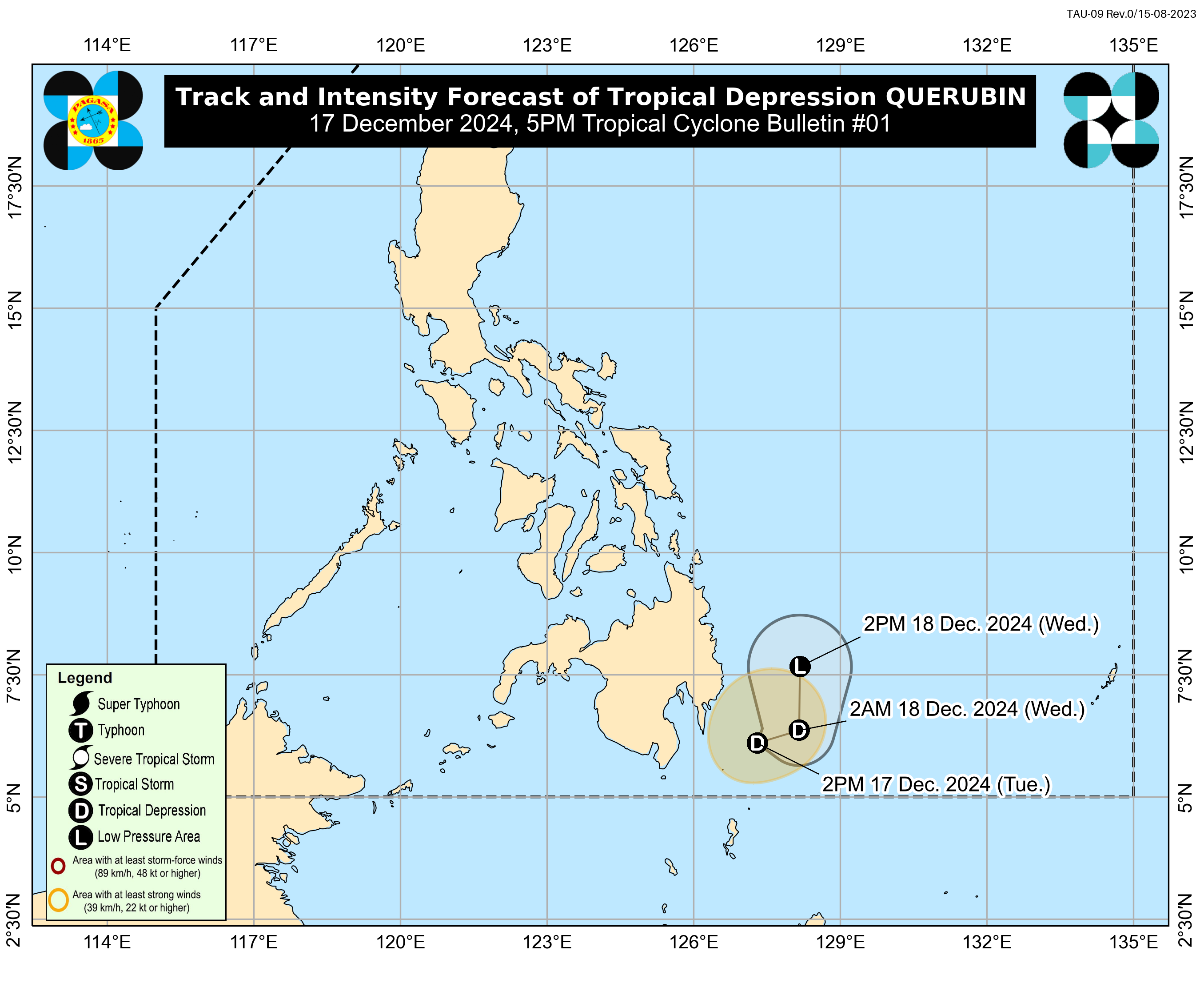
In its tropical cyclone bulletin issued at 5:00 p.m., the Philippine Atmospheric, Geophysical and Astronomical Services Administration (PAGASA) said that Querubin was last monitored 215 kilometers east-southeast of Davao City, moving south-southwestward slowly.
The tropical depression packs maximum sustained winds of 45 kilometers per hour near the center and gustiness of up to 55 kph.
Strong winds may be experienced in Davao Oriental, which is placed under Tropical Cyclone Wind Signal No. 1.
In its track forecast, PAGASA said Querubin will slowly move east-northeastward away from Davao Region before weakening into a “remnant low”.
It will then traverse Mindanao and Palawan between Wednesday (Dec. 18) afternoon until Sunday afternoon (Dec. 22).
However, PAGASA also stressed that Querubin’s “track may still shift within the limit of the forecast confidence cone.”
Meanwhile, the tropical depression and the shear line is forecast to bring heavy to intense rainfall over Dinagat Islands, Surigao del Sur, Davao Oriental, and Surigao del Norte until Wednesday afternoon.
Moderate to heavy rains may also be experienced in Quezon, Camarines Norte, Camarines Sur, Albay, Catanduanes, Sorsogon, Masbate, Eastern Samar, Northern Samar, Leyte, Southern Leyte, Biliran, Agusan del Norte, Agusan del Sur, Davao Occidental, Davao del Sur, Davao del Norte, Davao del Norte, Davao de Oro, Samar, and Davao Occidental.
Residents in these areas are advised to remain vigilant or follow instructions from their local officials, as heavy rains may cause flooding and landslides.
-av
