
By Dean Aubrey Caratiquet
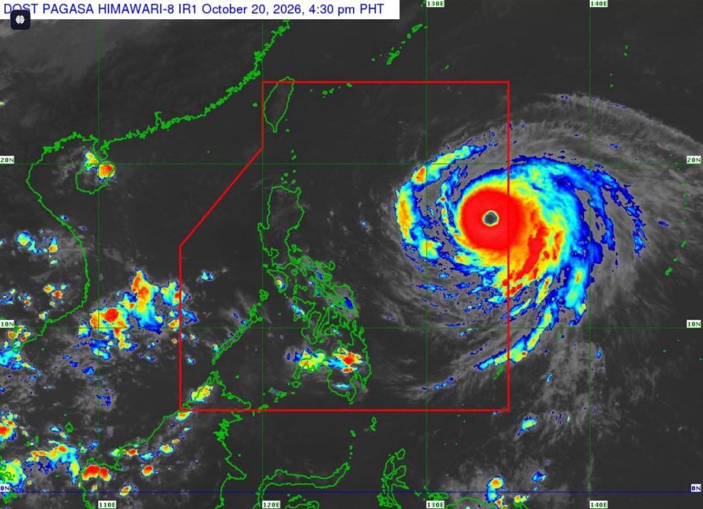
After entering the Philippine area of responsibility (PAR) at 10:40 a.m. Tuesday, Super Typhoon Rosal slightly intensified as it continued on its west-northwestward track, hovering over the Philippine Sea.
According to PAGASA’s 5:00 p.m. bulletin, Rosal (international name: Champi) was last located 1,270 km east of Central Luzon, packing maximum sustained winds of 195 kph and gustiness of up to 240 kph as it moves west northwestward at 25 kph.
Tropical Cyclone Wind Signal No. 1 continues to prevail in the following areas, which are expected to experience winds of 39-61 kph or intermittent rains over the next 36 hours:
- Batanes
- Babuyan Islands
- Cagayan
- Isabela
- Catanduanes
The state weather bureau, moreover, issued a Gale Warning advisory over the seaboard of Extreme Northern Luzon and the eastern seaboards of Northern and Southern Luzon, advising fisherfolk and owners of small seacrafts to urge great caution in sailing on open water due to very rough seas and high waves in these coastal waters.
Rough seas are also expected over the following coastal waters:
- Up to 4.0 m: the northern and eastern seaboards of Batanes, the remaining eastern seaboards of Babuyan Islands, and mainland Cagayan; the northern seaboards of Camarines Norte and Camarines Sur; the northern and eastern seaboards of Northern Samar and Eastern Samar; the eastern seaboards of Albay and Sorsogon.
- Up to 3.5 m: The northern and eastern seaboard of Polillo Islands; the northern seaboard of Aurora; the remaining seaboard of Batanes.
- Up to 3.0 m: The seaboards of northern Quezon; the eastern seaboards of Dinagat Islands and Siargao-Bucas Grande Island Group; the remaining seaboards of Cagayan, Aurora and Camarines Norte.
Super Typhoon Rosal is forecast to move west-northwestward until Wednesday, before moving generally northwestward until October 23, before turning northward until it exits PAR on late Friday or early Saturday.
It is expected to maintain its strength as a super typhoon but may further intensify as it moves over the Philippine Sea.
av

