
By Alec Go
Several portions of Luzon are under Tropical Cyclone Wind Signal (TCWS) No. 1 as Tropical Storm “Goring” continued to intensify while slowly moving south southwestwardly on Friday morning, Aug. 25, according to the state weather bureau.
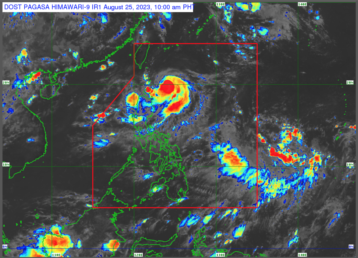
As of 10:00 a.m., the storm’s center was estimated at 225 kilometers (km) east southeast of Basco, Batanes or 270 km east of Calayan, Cagayan, with maximum sustained winds of 85 km per hour (km/h) near the center and gustiness of up to 105 km/h.
TCWS No. 1 is hoisted over the following areas as of 11:00 a.m.:
- Batanes
- Eastern portion of Babuyan Islands (Babuyan Is., Camiguin Is.)
- Eastern portion of mainland Cagayan (Santa Ana, Gonzaga, Lal-Lo, Gattaran, Baggao, Peñablanca, Santa Teresita, Buguey, Camalaniugan, Aparri)
- Eastern portion of Isabela (Maconacon, Divilacan, Palanan, Dinapigue, San Mariano, San Pablo, Cabagan, Tumauini, Ilagan City)
The Philippine Atmospheric, Geophysical and Astronomical Services Administration (PAGASA) said the storm’s trough will bring cloudy skies with scattered rain showers and thunderstorms over Cagayan Valley, Ilocos Region, and the Cordillera Administrative Region.
The southwest monsoon or habagat will also bring cloudy skies with scattered rain showers and thunderstorms over Palawan, Occidental Mindoro, Zambales, and Bataan.
Habagat and localized thunderstorms will also bring partly cloudy to cloudy skies with isolated rain showers or thunderstorms over the rest of the country.
For Friday until Saturday noon, heavy rainfall is expected over Batanes, Babuyan Islands, and the northeastern portion of mainland Cagayan.
PAGASA weather specialist Ana Clauren-Jorda said “Goring” is forecast to intensify within the next 24 hours and be raised to severe tropical storm category.
After 48 hours or by Sunday, “Goring” is forecast to be at 205 km east northeast of Casiguran, Aurora, where it may further intensify and reach typhoon category.
“Pagsapit ng Lunes, nasa layo na itong 340 km silangan hilagang-silangan ng Casiguran, Aurora at mapapanatili ang lakas na typhoon,” Jorda said.
PAGASA said “the potential for developing into a super typhoon is not ruled out.”
A gale warning is currently in effect over the coastal waters of Batanes, Babuyan, and the northern coast of mainland Cagayan due to strong winds associated with the storm.
Meanwhile, another low pressure area was monitored outside the Philippine Area of Responsibility at 1,935 km east of Eastern Visayas which currently does not have any direct effect over the country.