
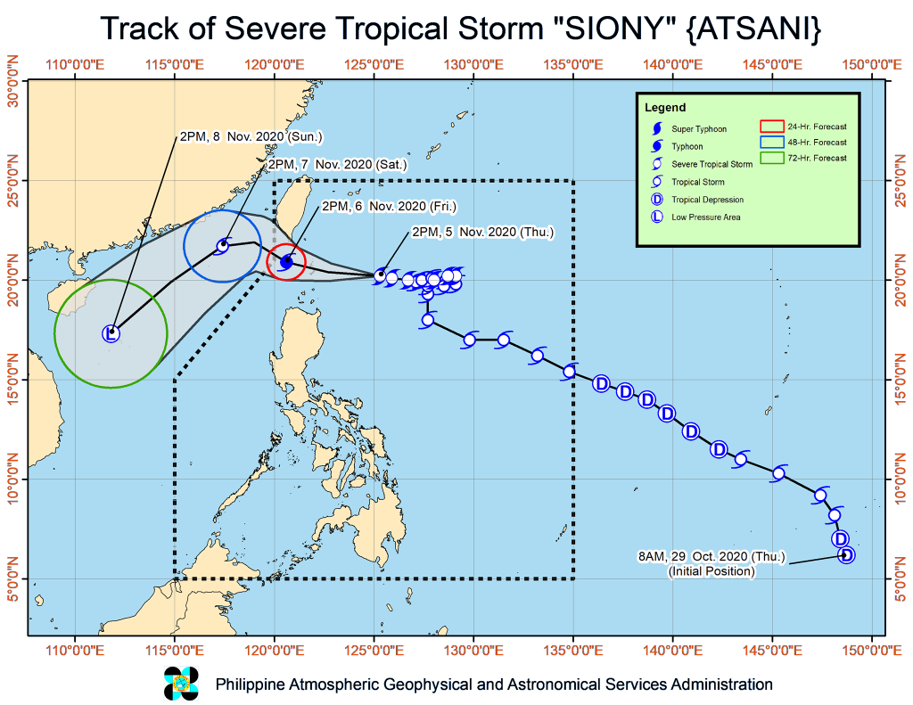
Tropical Cyclone Wind Signal No. 2 has been raised over Batanes and Babuyan Islands as severe tropical storm Siony “slightly intensifies as it moves closer towards Luzon strait.”
As of 4 p.m. om Thursday, Siony was spotted 340 km east of Basco, Batanes and is moving westward at 20 km/hour. It has maximum sustained winds of 100 km/h near the center and gustiness of up to 125 km/h.
Tropical Cyclone Wind Signal No. 1 has been raised over areas of Cagayan such as Santa Ana, Gonzaga, Lal-Lo, Allacapan, Santa Teresita, Buguey, Camalaniugan, Aparri, Ballesteros, Abulug, Pamplona, Sanchez-Mira, Claveria and Santa Praxedes.
Tropical Cyclone Wind Signal No. 1 has also been raised over some towns of Apayao, including Santa Marcela, Luna, Calanasan; and portions of Ilocos Norte, including Adams, Pagudpud, Bangui, Dumalneg, Burgos, Vintar, Pasuquin, Bacarra.
The 5:00 PM weather bulletin of the PAGASA forecasts that Siony will keep on moving westward or west-northwestward in the next 24 hours.
“On the forecast track, the center of Siony will likely pass over (landfall) or near (close approach) the vicinity of Batanes or Babuyan Islands tomorrow morning,” it further states.
Siony could reach typhoon category with a peak intensity of 120 km/h by Friday morning, according to PAGASA. It is expected to exit the Philippine Area of Responsibility by Friday afternoon or evening.
Moderate to heavy rains will start affecting Batanes and Babuyan Islands on Friday morning. Siony’s trough and the Inter Tropical Convergence Zone (ITCZ) “will bring scattered light to moderate with at times heavy rain showers over most parts of Central Luzon, CALABARZON, MIMAROPA, Bicol Region, Visayas, and Mindanao.” – PTV News Online