
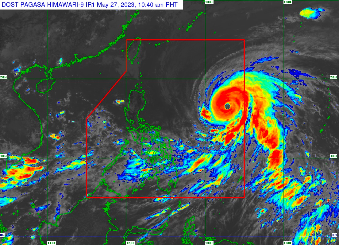
The state weather bureau on Saturday morning, May 27, raised wind signal no. 1 over parts of Cagayan and Isabela, as Super Typhoon (ST) “Betty” maintained its strength while moving west northwestward.
In its 11:00 a.m. bulletin, the Philippine Atmospheric, Geophysical and Astronomical Services Administration (PAGASA) said the center of ST “Betty” was spotted 1,170 kilometers east of Central Luzon with maximum sustained winds of 195 kilometers per hour (km/h) near the center, and gustiness of up to 240 km/h.
Tropical Cyclone Wind Signal No. 1 is hoisted over these areas:
Eastern portion of Cagayan
– Santa Ana
– Gonzaga
– Lal-Lo
– Gattaran
– Baggao
– Peñablanca
– Santa Teresita
– Buguey
– including Babuyan and Camiguin Islands
Eastern portion of Isabela
– Maconacon
– Divilacan
– Dinapigue
– Palanan
– San Mariano
– Ilagan City
– Tumauini
– San Pablo
– Cabagan
PAGASA said “Betty” is forecast to remain as a super typhoon over the weekend.
“On Monday, the tropical cyclone will turn northwestward and decelerate as it moves over the waters east of Extreme Northern Luzon. Betty may eventually become almost stationary between late Tuesday and early Wednesday when it will be closest to Batanes,” it added.
PAGASA stressed that monsoon rains from the enhanced Southwest Monsoon are possible over the western sections of Mimaropa, Visayas, and Mindanao on Sunday, May 28. CF