By Brian Campued
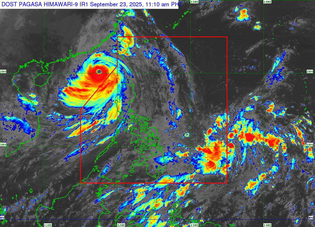
Super Typhoon Nando maintained its strength as it exited the Philippine area of responsibility (PAR) on Tuesday morning, the state weather bureau said.
In its 11:00 a.m. bulletin, the Philippine Atmospheric, Geophysical and Astronomical Services Administration (PAGASA) said Nando (international name: “Ragasa”) was last spotted 385 km west-northwest of Calayan, Cagayan.
The super typhoon packs maximum sustained winds of 185 kph and gustiness of up to 230 kph, while moving west-northwestward towards south of mainland China at 20 kph.
Due to Nando’s wide circulation, the Tropical Cyclone Wind Signal (TCWS) No. 2 remains hoisted over the western portion of Babuyan Islands (Calayan Island, Panuitan Island, Dalupiri Island, Irao Island, Mabag Island, Barit Island, and Fuga Island,), the northwestern portion of mainland Cagayan (Claveria, Sanchez-Mira, and Santa Praxedes), the northern portion of Apayao (Calanasan), and Ilocos Norte.
Gale-force winds in areas under TCWS No. 2 may cause minor to moderate threats to life and property.
Minimal to minor impacts from strong winds are likewise possible in the following locales under TCWS No. 1:
- Batanes
- Rest of Babuyan Islands
- Rest of mainland Cagayan
- Northern portion of Isabela (San Manuel, Roxas, Mallig, Quezon, Santa Maria, Cabagan, Santo Tomas, Delfin Albano, Quirino, Tumauini, San Pablo, and Maconacon)
- Rest of Apayao
- Abra
- Kalinga
- Mountain Province
- Ifugao
- Benguet
- Ilocos Sur
- La Union
- Northwestern portion of Pangasinan (Bolinao, Anda, Agno, Dasol, Sual, Burgos, City of Alaminos, Bani, and Mabini)
Nando will continue to enhance the southwest monsoon, bringing up to intense rains over La Union, Pangasinan, Benguet, Zambales, Bataan, Ilocos Norte, Ilocos Sur, Tarlac, Pampanga, Cavite, Batangas, and Occidental Mindoro until Wednesday noon, Sept. 24.
PAGASA also warns against sea travel due to very rough to high sea conditions over the northern seaboards of Batanes, Babuyan Islands, and Ilocos Norte; and the western and eastern seaboards of mainland Cagayan, Ilocos Sur, La Union, and the northern coast of Pangasinan.
A storm surge warning is likewise still raised over the low-lying or exposed coastal localities of mainland Cagayan, Ilocos Sur, La Union, and the northern coast of Pangasinan—with peak heights of up to 2 meters possible within the next 12 hours.
Tropical depression monitored outside PAR
In a public briefing, PAGASA weather specialist John Manalo said the tropical depression that formed east of the country on Tuesday morning may enter the PAR within the day, and will be given the local name “Opong”.
The tropical depression was last located 1,075 km east of Eastern Visayas. It packs maximum sustained winds of 55 kph and gustiness of up to 70 kph and is moving westward at 35 kph.
“Ang tatahakin nito ay pa-west-northwest papunta dito sa Southern Luzon—sa Bicol Region to be particular sa mga susunod na araw,” Manalo said.
Inside PAR, the potential “Opong” is forecast to intensify into a tropical storm as it approaches the Eastern Visayas-Southern Luzon area.
“Babaybayin niya ‘yung coastal areas dito sa Eastern Visayas or sa Bicol Region, at tatagos po ‘yan or magla-landfall siya somewhere dito sa CALABARZON, Bicol Region, o sa MIMAROPA,” Manalo said.
-jpv
