
By Dean Aubrey Caratiquet
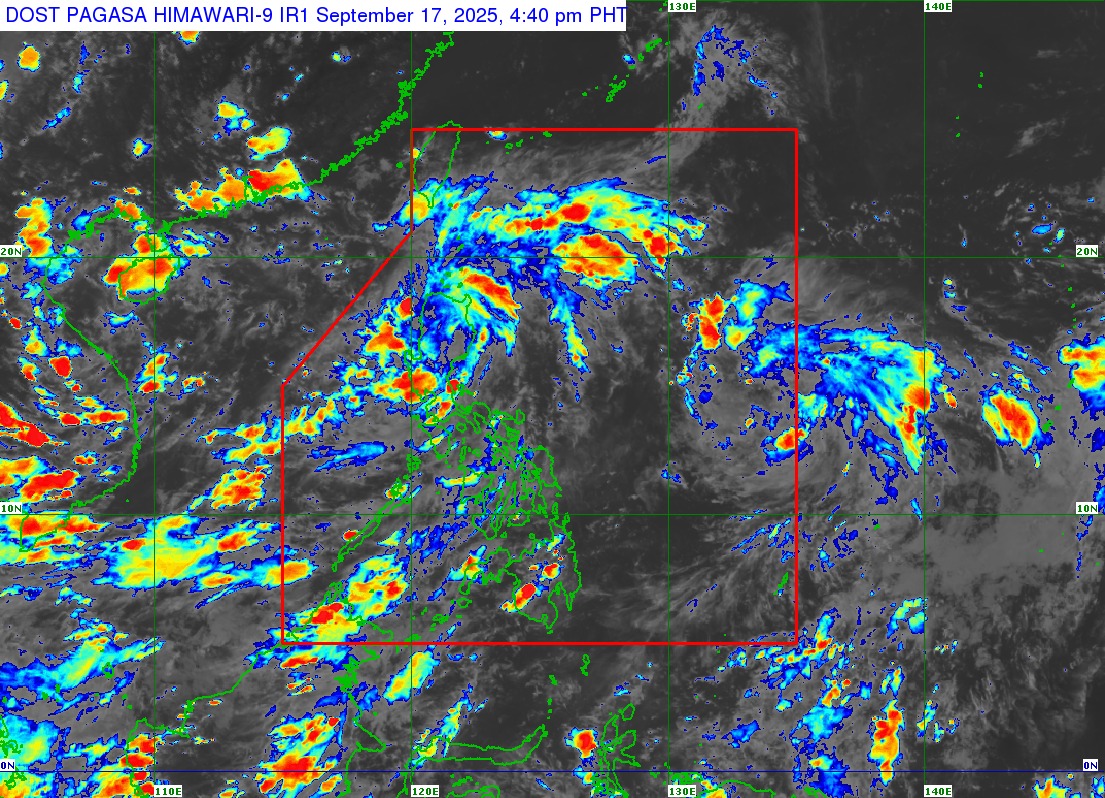
After making landfall over Casiguran, Aurora at 3:20 a.m., Tropical Depression Mirasol continues its path across Northern Luzon, according to the Philippine Atmospheric, Geophysical, and Astronomical Services Administration’s (PAGASA) 5:00 p.m. bulletin.
Mirasol was last located in the vicinity of Kabugao, Apayao, packing maximum sustained winds of 55 km/h near the center and gustiness of up to 90 km/h as it moves northwestward at 20 km/h.
PAGASA has raised Tropical Cyclone Wind Signal (TCWS) No. 1 over the following areas in Regions 1, 2, and Cordillera Administrative Region (CAR):
– Batanes
– Cagayan including Babuyan Islands
– Western and northern portions of Isabela
– Northwestern portion of Quirino
– Northern portion of Nueva Vizcaya
– Apayao
– Abra
– Kalinga
– Mountain Province
– Ifugao
– Northern portion of Benguet
– Ilocos Norte
– Ilocos Sur
– Northern portion of La Union
The state weather bureau, meanwhile, cautioned owners of marine vessels and motorbancas, with up to 3-meter high waves expected over the eastern seaboard of mainland Cagayan and the seaboard of Isabela.
Up to 2.5-meter-high waves may also be experienced over the remaining seaboards of mainland Cagayan and the seaboards of Babuyan Islands, Batanes, Aurora, Ilocos Norte, and Ilocos Sur.
PAGASA Weather Specialist Benison Estareja said in the press briefing, “Yong northern at central Luzon ay direktang apektado na po ng malalakas na hangin at ulan dulot ng Bagyong Mirasol. Dito naman po sa may Southern Luzon, kabilang ang Metro Manila; maging dito rin sa western sections ng Visayas and Mindanao, mayroong southwest monsoon o hanging habagat na unti-unting pinalalakas ng bagyo.”
TD Mirasol is expected to maintain its strength and stay on its track as it traverses Northern Luzon and may re-emerge over the coastal waters of Ilocos Norte tonight. PAGASA also expects the weather system to intensify into a tropical storm within the next 12 hours.
PAGASA is also monitoring a Tropical Depression that formed earlier on Wednesday. The state weather bureau expects this weather disturbance to increase in strength and change trajectory as it nears the Philippine landmass.
The weather system, which would be named “Nando” upon entering the Philippine Area of Responsibility (PAR) on Thursday, was last located 1,245 km. east of southeastern Luzon, packing maximum sustained winds of 45 km/h and gustiness of up to 55 km/h as it moves west-northwestward at 25 km/h.
av