
By Dean Aubrey Caratiquet
The low pressure area that formed east of southeastern Luzon developed into Tropical Depression Kiyapo at 8:00 p.m. on Wednesday.
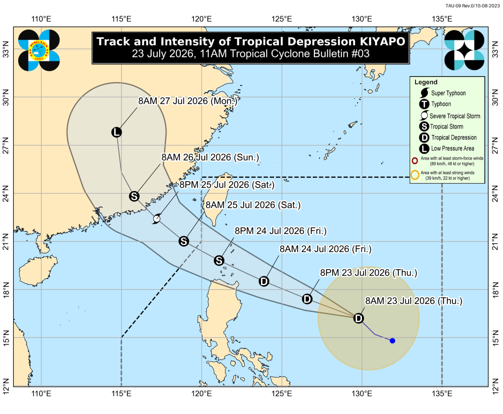
In PAGASA’s 11:00 a.m. bulletin, Kiyapo was last located 830 km east of northern Luzon, packing maximum sustained winds of 45 kph and gustiness of up to 55 kph as it moves northwestward at 25 kph.
With the tropical cyclone fast approaching the landmass of northern Luzon, the state weather bureau has hoisted Tropical Cyclone Wind Signal No. 1 in the following areas, which may experience winds of 39-61 kph or intermittent rains in the next 36 hours:
- Batanes
- Cagayan (including Babuyan Islands)
- Isabela
- Apayao
- Abra
- Kalinga
- Mountain Province
- Ifugao
- Ilocos Norte
- Ilocos Sur
- Aurora
- Quirino
- Nueva Vizcaya
While PAGASA is yet to issue any gale warning advisory over the seaboards of Extreme Northern Luzon, the state weather bureau warns of rough seas generating up to 3.0-meter-high waves over the eastern seaboards of Batanes and Davao Oriental.
Kiyapo is expected to continue on its west northwestward track until Saturday (July 25). The center of the tropical cyclone may pass very close to the tip of mainland Cagayan between Friday (July 24) morning and afternoon, before passing or making landfall in the vicinity of Babuyan Islands late Saturday.
The weather system is likewise expected to gradually intensify as it hovers over the Philippine Sea, with the possibility of reaching tropical storm category on Friday.
jpv

