
By Alec Go
Tropical Storm Karding will bring light to heavy rains over several portions of Northern Luzon over the weekend as it maintains strength, with the possibility of hoisting tropical cyclone wind signals as early as Friday night, Sept. 23, the weather bureau said.
The Philippine Atmospheric, Geophysical and Astronomical Services Administration (PAGASA) said Batanes, Cagayan, and Isabela will experience light to moderate with at times heavy rains Saturday evening through early Sunday morning due to Karding.
The Cordillera Administrative Region, Cagayan, Isabela, Ilocos Provinces, and La Union will experience moderate to heavy rains with at times intense rains on Sunday through early Monday morning. Light to moderate with at times heavy rains will also prevail over the northern portion of Aurora and the rest of Ilocos Region and Cagayan Valley.
PAGASA clarified that rains until the next 24 hours are still caused by habagat.
As of at 10:00 a.m., Karding was at 1,085 kilometers (km) east of Northern Luzon with maximum sustained winds of 65 km/h and gustiness of up to 80 km/h.
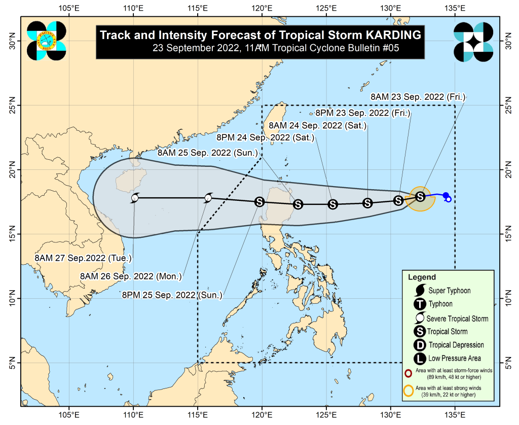
It intensified into a tropical storm on Thursday afternoon, but may still turn into a severe tropical storm before making a landfall on Sunday morning, PAGASA senior weather specialist Raymond Ordinario said.
“Inaasahan natin na ito ay magla-landfall dito (Cagayan), possible na maghatak na ito ng habagat at magpaulan over the entire Luzon area including Metro Manila,” he said.
“Pagplanuhan natin ang mga magiging activities natin on Sunday and Monday, ito ang crucial period na dadaan itong si Karding sa Northern Luzon,” he added, noting that the storm will pass through Cagayan, Cordillera, and Ilocos.
Tropical Cyclone Wind Signal (TCWS) No. 2 may be the highest wind signal that will be raised, but the possibility for a TCWS No. 3 has not yet been ruled out. – gb