
By Alec Go
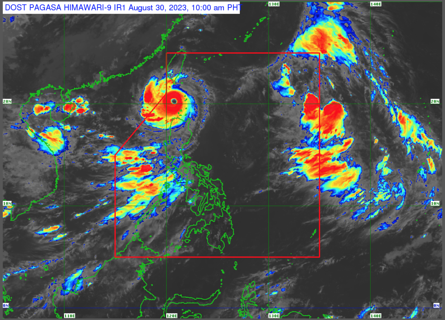
Super Typhoon “Goring” has maintained its strength while moving over the sea off Batanes and will “likely remain as a super typhoon until Friday,” according to the latest bulletin of PAGASA.
As of 10:00 a.m. the eye of “Goring” was 125 kilometers (km) west southwest of Basco, Batanes with maximum sustained winds of 195 km per hour (km/h) near the center and gustiness of up to 240 km/h.
As of 11:00 a.m., Tropical Cyclone Wind Signals (TCWS) are hoisted over the following areas:
TCWS No. 2
- Batanes
- Babuyan Islands
TCWS No. 1
- Ilocos Norte
- Apayao
- Northern portion of Abra (Tineg, Lagayan, Danglas)
- Ilocos Sur (Sinait, Cabugao, San Juan)
- Northern and central portion of Cagayan (Amulung, Santo Niño, Piat, Rizal, Lasam, Gattaran, Santa Ana, Gonzaga, Lal-Lo, Santa Teresita, Buguey, Baggao, Alcala, Camalaniugan, Aparri, Allacapan, Ballesteros, Santa Praxedes, Claveria, Sanchez-Mira, Pamplona, Abulug)
- PAGASA said Batanes and northeastern Cagayan including Babuyan Islands will experience stormy weather conditions due to “Goring,” while rains and gusty winds will prevail over Ilocos Norte, Apayao, and the rest of mainland Cagayan.
The southwest monsoon or habagat will bring monsoon rains over Zambales, Bataan, Occidental Mindoro, and the northern portion of Palawan.
Occasional rains are expected over Metro Manila, the rest of Ilocos Region, the rest of Mimaropa, Tarlac, Pampanga, Bulacan, Cavite, and Batangas.
The rest of Luzon, the rest of Western Visayas, and Zamboanga Peninsula will have cloudy skies with scattered rain showers and thunderstorms.
The rest of the country will also have partly cloudy to cloudy skies with isolated rain showers or thunderstorms.
PAGASA said “there is a moderate to high risk of storm surge which may cause flooding in the low-lying and exposed coastal areas of Batanes and the northern and western portions of Babuyan Islands.”
A gale warning is also in effect for most seaboards of Luzon and Visayas, and the eastern seaboard of Mindanao.
“Goring” is forecast to exit the Philippine area of responsibility on Wednesday night or Thursday morning. – gb