
By Brian Jules Campued
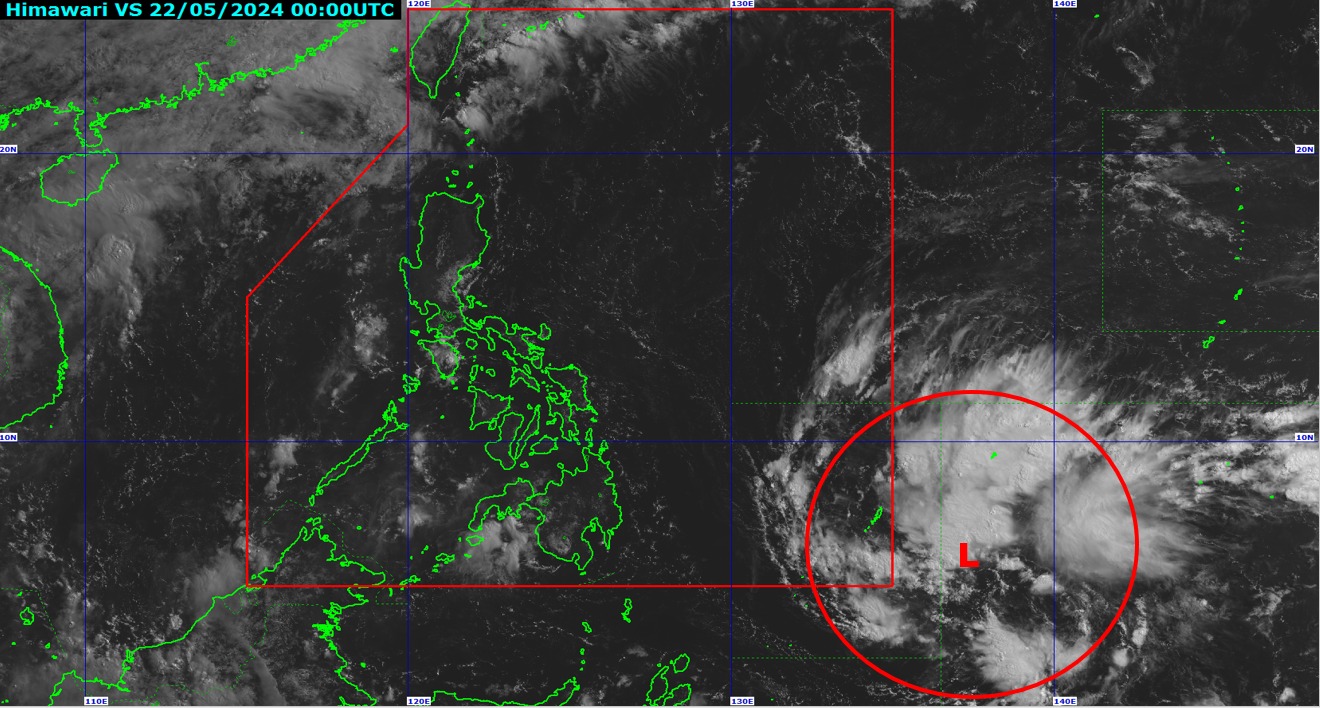
The cloud clusters east of Mindanao being monitored by the Philippine Atmospheric, Geophysical, and Astronomical Services Administration (PAGASA) developed into a low pressure area (LPA) on Wednesday morning.
During the PAGASA’s 172nd Climate Forum, weather specialist Loriedin de la Cruz-Galicia said the LPA, which developed at 8 a.m., was located 1,255 kilometers east of southeastern Mindanao.
The LPA may also enter the Philippine area of responsibility (PAR) either Wednesday evening or Thursday morning (May 23).
Galicia noted that the LPA may affect or make landfall over the Bicol and Eastern Visayas regions by late Friday (May 24) or Saturday (May 25).
Afterwards, it will emerge over the waters east of Luzon and may develop into a tropical depression around Sunday (May 26) or Monday (May 27).
“Hindi natin niru-rule out yung possibility na mag-develop po ito into a tropical depression after emerging in the waters east of Luzon,” she pointed out.
The LPA, should it develop into a tropical depression and enter the PAR, will be named “Aghon” — the first tropical cyclone for 2024.
However, in another scenario, the weather disturbance may instead re-curve over the Philippine Sea near the Bicol – Eastern Visayas section and develop into a tropical depression by Friday or Saturday.
This is due to the possible weakening of the ridge of a high pressure area earlier than the previous scenario stated.
“Ibig sabihin po nito, likely na mas mag-develop siya into a tropical depression kapag nag-stay siya offshore or sa coastal waters,” the weather specialist added.
The state weather bureau warned that the trough of the LPA may bring scattered rain showers and thunderstorms over the eastern portion of the country – particularly, southern Luzon and Eastern Visayas – starting Friday, triggering flash floods and landslides.
“Ating abiso po [sa publiko], mag-monitor po tayo sa magiging updates ng PAGASA regarding this weather system. Especially by weekend dahil possible ang mga pag-ulan sa mga nabanggit na lugar and mag-monitor sa possible weather advisory na ipapalabas ng PAGASA,” de la Cruz-Galicia said.
PAGASA previously said the rainy season may begin between the last week of May to June 15. – iro