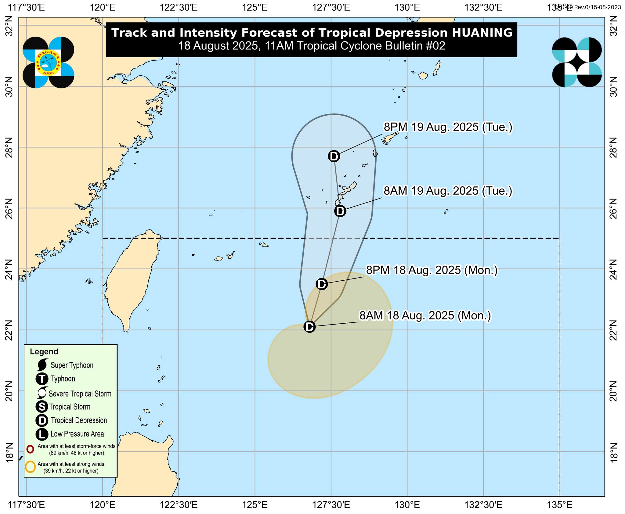
TD Huaning maintains northward movement, may exit PAR Tuesday

Photo courtesy: DOST-PAGASA

By Dean Aubrey Caratiquet

After developing into a tropical depression within the Philippine Area of Responsibility (PAR) on Monday, TD Huaning continues to move northward over the Pacific Ocean, as it increased in strength, according to the Philippine Atmospheric, Geophysical, and Astronomical Services Administration’s (PAGASA) 11:00 a.m. bulletin.

Huaning was last located at 535 km. east north-east of Itbayat, Batanes, packing maximum sustained winds of 55 km/h near the center and gustiness of up to 70 km/h.

The weather disturbance has slowed in movement as it continues its trajectory towards Okinawa Islands.

No tropical cyclone wind signals have been hoisted, with PAGASA noting that Huaning is unlikely to affect the country’s weather.

The state weather bureau also said that Huaning may intensify into a tropical storm prior to exiting PAR tonight or on Tuesday.

avds

Popular

PH, Australia to seal defense cooperation pact in 2026

By Priam Nepomuceno | Philippine News Agency The Philippines and Australia on Friday signed a statement of intent to pursue a Defense Cooperation Agreement that...

Iconic ‘70s ‘Love Bus’ returns in Metro Cebu, Davao City

By Brian Campued The nostalgia is strong in the air as the iconic “Love Bus” from the 1970s is finally revived and now plies the...

Gov’t ramps up interventions for Tropical Depression ‘Isang’

By Brian Campued The National Disaster Risk Reduction and Management Council (NDRRMC) raised the blue alert status on Friday to monitor the possible effects of...

LPA east of Aurora now TD ‘Isang’; Signal No. 1 up in Northern, Central Luzon

By Brian Campued The low pressure area east of Aurora developed into Tropical Depression Isang and has already made landfall over Casiguran, Aurora on Friday...