By Dean Aubrey Caratiquet
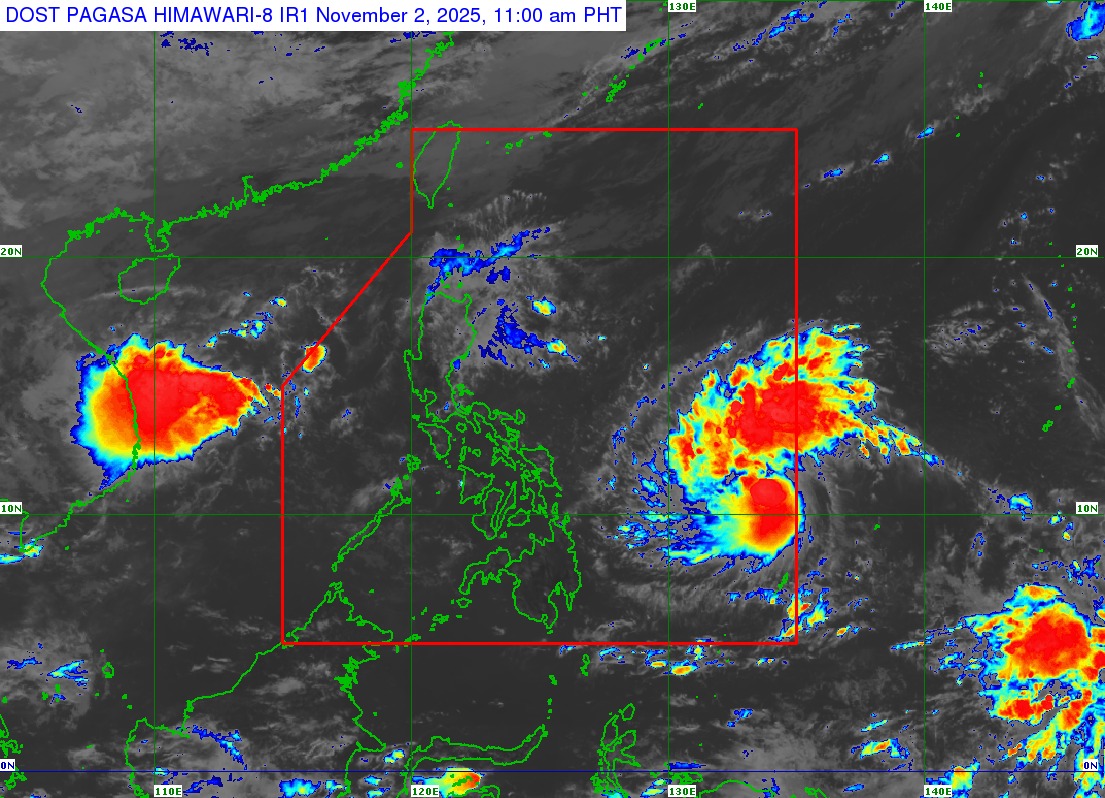
After forming into a tropical depression on Saturday and entering the Philippine Area of Responsibility (PAR) at 5:30 a.m. on Sunday morning, Tropical Storm Tino is expected to continue on a generally westward track towards Visayas, according to the Philippine Atmospheric, Geophysical, and Astronomical Services Administration’s (PAGASA) 11:00 a.m. bulletin.
Tino (international name: Kalmaegi) was last located 955 km east of Eastern Visayas, packing maximum sustained winds of 85 kph near the center and gustiness of up to 105 kph, as it moves westward at 30 kph.
The state weather bureau has already hoisted Tropical Cyclone Wind Signal (TCWS) No. 1 in Eastern Samar, Dinagat Islands, Siargao at Bucas Grande Islands due to Tino’s closer proximity to the Philippine landmass.
PAGASA likewise warned of strong winds over Eastern Visayas and Caraga, with Wind Signal No. 4 cited as the highest possible warning once it makes landfall.
Coastal floods in low-lying localities in Visayas, several portions of Southern Luzon, and Mindanao are likewise expected to take place, induced by storm surge associated with Tino.
A gale warning may also be raised over the eastern seaboard of Eastern Visayas and Caraga region, in anticipation of rough seas over the following coastal areas:
- Up to 4.0 m: The seaboards of Batanes and Babuyan Islands; the eastern seaboards of mainland Cagayan and Isabela.
- Up to 3.5 m: The remaining seaboard of mainland Cagayan; the seaboard of Ilocos Norte; the eastern seaboards of Eastern Samar, Dinagat Islands, and Siargao and Bucas Grande Islands.
- Up to 3.0 m: The seaboards of Ilocos Sur, Aurora, northern mainland Quezon, and Camarines Norte; the northern and eastern seaboards of Polillo Islands, Catanduanes, and Northern Samar; the northern seaboard of Camarines Sur; the eastern seaboards of Albay and Sorsogon.
PAGASA, meanwhile, noted that Tino may make its initial landfall over Eastern Samar or Dinagat Islands on Monday evening (Nov. 3) or Tuesday morning (Nov. 4), traversing Visayas and Northern Palawan before emerging on the West Philippine Sea on Wednesday (Nov. 5).
While in the Pacific Ocean, the weather system will continue to intensify and may reach typhoon category in the next 24 hours.
av
