Dailymotion
Facebook
Instagram
TikTok
Twitter
Youtube
Home
Nation
Local News
Provincial News
World
Business
Science
Technology
Entertainment
Arts and Culture
Search
PTV Para sa bayan
Official Online News of PTV
PTV Para sa bayan
Official Online News of PTV
PTV Para sa bayan
Official Online News of PTV
Search
LIVESTREAM
Facebook
Dailymotion
Youtube
Twitter
Home
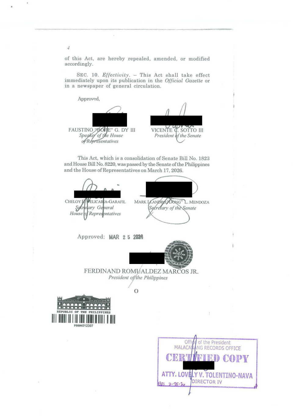
Screenshot 2026-03-26 at 1.22.48 PM
Screenshot 2026-03-26 at 1.22.48 PM
Screenshot 2026-03-26 at 1.22.48 PM