
By Brian Campued
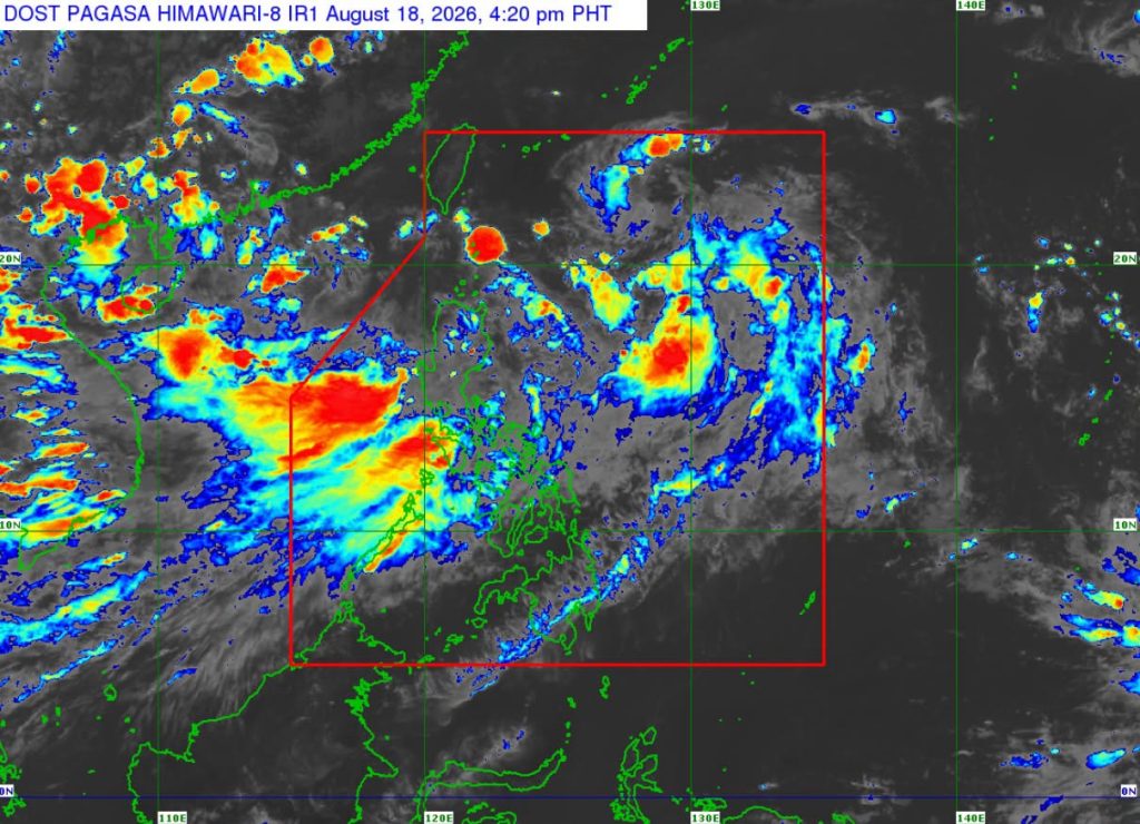
The western section of the country will continue to experience heavy rains in the coming days as the southwest monsoon (habagat) will be enhanced by Tropical Depression Neneng as it traverses the northern Philippine Sea.
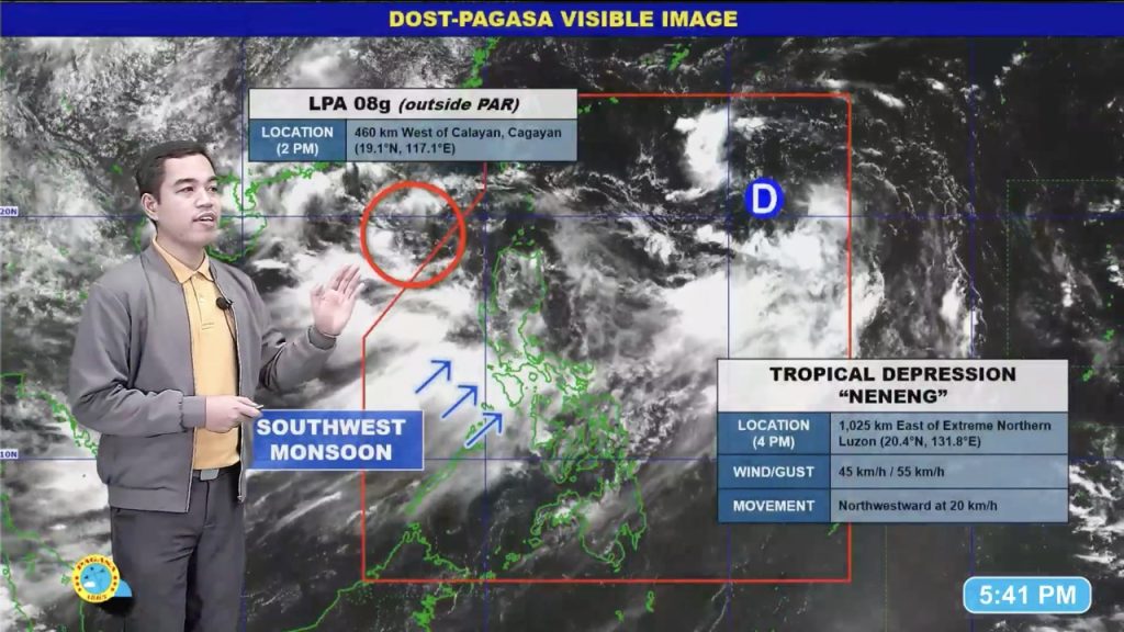
Based on the Philippine Atmospheric, Geophysical and Astronomical Services Administration’s (PAGASA) bulletin issued at 5:00 p.m. Tuesday, Tropical Depression Neneng was located 1,025 km east of extreme northern Luzon. It packs maximum sustained winds of 45 kph and gustiness of up to 55 kph, while moving northwestward at 20 kph.
“Base sa ating latest satellite animation, wala pang direktang ang nasabing bagyo subalit asahan yung unti-unting paghila nito ng southwest monsoon o ng hanging habagat na siyang magdadala pa rin po ng mga paminsan-minsang malalakas ulan sa susunod na dalawang araw habang binabagtas nitong Bagyong Neneng ang northern Philippine Sea,” PAGASA Weather Specialist Benison Estareja said in a public briefing.
According to PAGASA, Neneng will continue moving generally west-northwestward and will remain far from the Philippine landmass. It also is expected to be a “short-lived tropical cyclone” as it may weaken into a remnant low after possible landfall over Taiwan over the next two days.
While no wind signal is hoisted, most parts of the country will experience strong to gale-force gusts due to the enhanced southwest monsoon, PAGASA said.
However, the enhanced habagat is forecast to bring heavy to intense rains or around 100-200 mm of rainfall over Zambales, Bataan, Cavite, Batangas, Occidental Mindoro, and Oriental Mindoro until Wednesday afternoon, Aug. 19.
Metro Manila, La Union, Benguet, Pangasinan, Ilocos Sur, Abra, Tarlac, Pampanga, Bulacan, Nueva Ecija, Laguna, Rizal, and Antique will likewise experience moderate to heavy rains or 50-100 mm of rainfall during the same period.
Between Wednesday and Thursday afternoon, Aug. 20, heavy to intense rains are forecast over Benguet, La Union, Pangasinan, Zambales, Bataan, and Occidental Mindoro, while moderate to heavy rains are likely over Ilocos Sur, Abra, Tarlac, Pampanga, Bulacan, Nueva Ecija, Metro Manila, Cavite, Batangas, Rizal, and Oriental Mindoro.
“Mataas pa rin po ang banta ng mga pagbaha sa mga low-lying areas at maging yung mga hindi na gaanong binabaha, posible po kayong makaranas ng mga flooding, dito rin sa mga malapit sa ilog, posibleng pag-apaw po nito,” Estareja said. “At sa mga kabundukan, nakatira sa mga mountainous areas, posible ang pagguho ng lupa.”
Meanwhile, the state weather bureau is monitoring a low-pressure area outside the Philippine area of responsibility (PAR), which has a high chance of developing into a tropical depression within the next 24 hours.
The LPA was last spotted 460 km west of Calayan, Cagayan, and is not forecast to directly affect the country’s weather.
“Ang nakikita nating movement nitong [LPA] within 24 hours, mabagal na kumikilos palayo ng ating kalupaan. So ibig sabihin, kahit ito naman ay maging bagyo, maliit ang tiyansa na magkakaroon agad tayo ng pang-apat na bagyo for the month of August dahil kikilos ito towards southern portion of China,” Estareja said.
-jpv

