
By Dean Aubrey Caratiquet
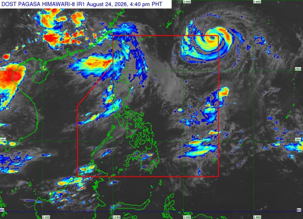
After weeks of monitoring by PAGASA, Typhoon Saudel entered the Philippine area of responsibility at 1:20 p.m. on Monday, and was assigned the domestic name ‘Obet.’
Obet was last located 1,350 km east-northeast of Extreme Northern Luzon, packing maximum sustained winds of 165 kph and gustiness of up to 205 kph as it moves west-northwestward at 30 kph.
Due to its distance from the Philippine landmass, no wind signals or gale warnings were issued by PAGASA. However, the state weather bureau advised of rough seas over the following coastal waters:
- Up to 3.5 m: The seaboard of Batanes; the northern seaboard of Babuyan Islands.
- Up to 3.0 m: The western seaboards of Babuyan Islands, the northern seaboard of Ilocos Norte, and the western seaboard of Kalayaan Islands.
PAGASA Weather Specialist Grace Castañeda-Carpio explained, “Sa ngayon po ay wala itong direct effect sa anumang bahagi ng ating bansa, ngunit sa mga susunod na araw habang kumikilos ito generally pa-northwestward is ma-e-enhance po nito yung habagat.”
Castañeda added that the enhanced southwest monsoon is expected to prevail over large parts of Luzon over the next few days, bringing cloudy skies with scattered rains in Metro Manila, Ilocos Region, Cordillera Administrative Region, Cagayan Valley, and Central Luzon, as well as the provinces of Cavite and Batangas.
Typhoon Obet is expected to maintain its west-northwestward trajectory before moving generally westward for the remainder of the forecast period.
Obet is likewise expected to slightly intensify while inside the PAR but may eventually exit the PAR within 12 hours.
Meanwhile, PAGASA continues to monitor the Tropical Storm with international name “Atsani” outside the PAR, with the weather system last located 1,765 km east of Central Luzon as of 4:00 p.m.
Atsani packs maximum sustained winds of up to 65 kph and gustiness of up to 80 kph as it moves east-northeastward at 35 kph.
av

