
By Brian Jules Campued
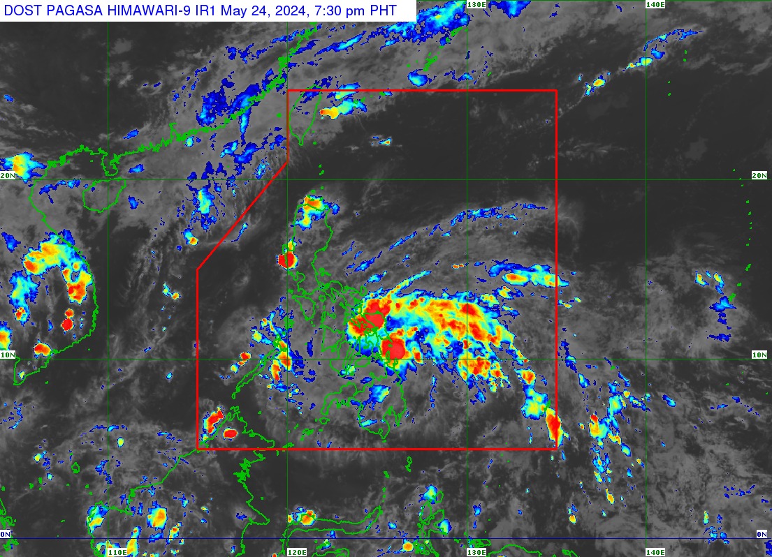
Tropical Depression Aghon could intensify into a tropical storm before making landfall over Eastern Samar or Dinagat Islands on Saturday morning, the Philippine Atmospheric, Geophysical and Astronomical Services Administration (PAGASA) said.
In its tropical cyclone bulletin issued at 8 p.m., PAGASA said Aghon was spotted 145 kilometers east of Surigao City, Surigao del Norte moving northwestward at 20 kilometers per hour (kph).
Aghon packs maximum sustained winds of 55 kph near its center and gustiness of up to 70 kph.
PAGASA said strong winds of up to 61 kph may be expected in at least 36 hours and may cause minimal to minor threat to life and property.
Due to this, TCWS no. 1 was hoisted over the following areas:
Signal No. 1
- Luzon
- Quezon (Calauag, Guinayangan, Lopez, Buenavista, Catanauan, Mulanay, San Narciso, San Francisco, San Andres, Tagkawayan)
- Sorsogon
- Albay
- Catanduanes
- Camarines Sur
- Camarines Norte
- Masbate including Ticao Island, and Burias Island
- Visayas
- Eastern Samar
- Samar
- Northern Samar
- Leyte
- Southern Leyte
- Biliran
- Cebu (San Remigio, Tabogon, City of Bogo, Medellin, Daanbantayan, Borbon) including Camotes Islands
- Bantayan Islands
- Bohol (Pres. Carlos P. Garcia, Bien Unido, Trinidad, Anda, Candijay, Ubay, Mabini, Alicia, San Miguel, Talibon)
- Mindanao
- Dinagat Islands
- Surigao del Norte including Siargao and Bucas Grande Islands
- Surigao del Sur
- Agusan del Sur (Sibagat, City of Bayugan, Prosperidad, San Francisco, Rosario, Bunawan, Trento)
- Agusan del Norte
According to a track forecast, PAGASA said Aghon could also make another landfall over Sorsogon, Albay, or Catanduanes area by Saturday evening.
“On Sunday (May 26), Aghon will begin recurving generally northward or north-northeastward over the waters east of Luzon while starting to continuously intensify,” the state weather bureau said.
“Current forecast scenario shows intensification into a severe tropical storm by Sunday and into a typhoon by Tuesday,” it added.
State meteorologists, likewise, warned of moderate to heavy rains occurring in Albay, Sorsogon, Eastern Visayas, Surigao del Norte, and Dinagat Islands until Saturday evening.
Light to moderate with at times heavy rains are expected over the southern portion of Quezon, Masbate including Ticao and Burias Islands, Catanduanes, the eastern portion of Camarines Sur, Western Visayas, Surigao del Sur, and Zamboanga del Norte.
PAGASA also advised mariners of motor bancas and similarly-sized vessels to take precautionary measures as the tropical depression may cause moderate to rough seas along the northern and eastern seaboards of Eastern Visayas as well as the eastern seaboard of Caraga Region.
“Considering these developments, the public and disaster risk reduction and management offices concerned are advised to take all necessary measures to protect life and property,” PAGASA said in an advisory.
“Persons living in areas identified to be highly or very highly susceptible to these hazards are advised to follow evacuation and other instructions from local officials,” it added. – avds