
By Dean Aubrey Caratiquet
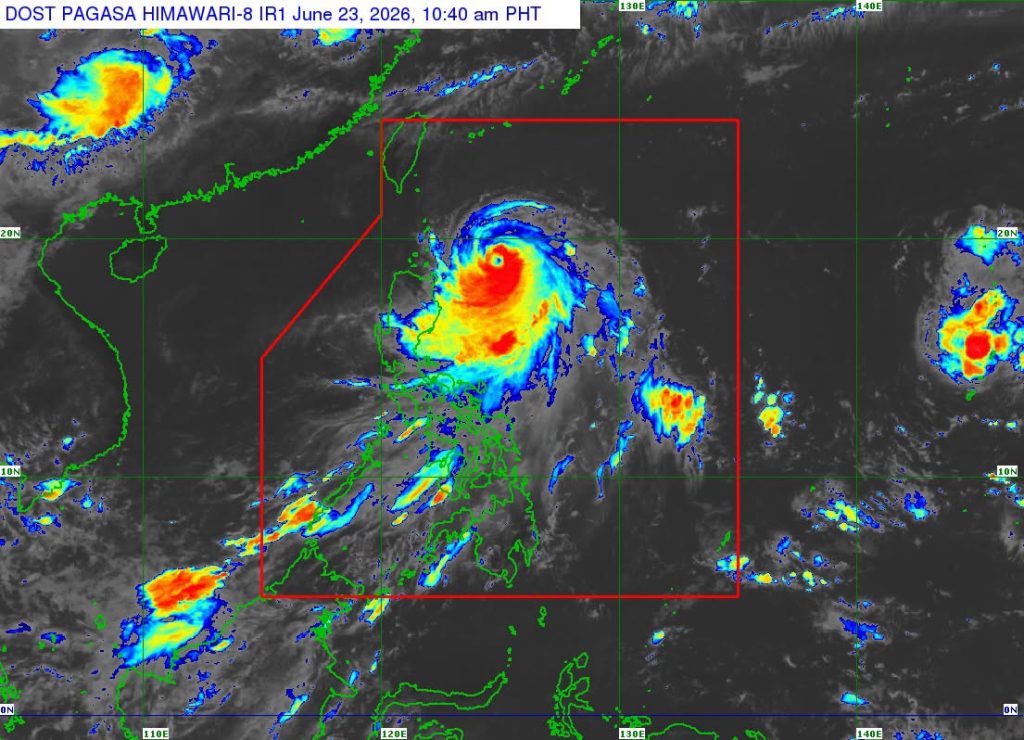
After a brief intensification into a supertyphoon on Monday, Typhoon Francisco (international name: Mekkhala) weakened into a typhoon at around 10:00 a.m. Tuesday.
According to PAGASA’s 11:00 a.m. bulletin, Francisco was last located 375 km east northeast of Aparri, Cagayan, packing maximum sustained winds of 175 kph and gustiness of up to 215 kph as it moves northwestward at 10 kph.
Due to its close proximity to extreme northern Luzon, the state weather bureau has raised Tropical Cyclone Wind Signal No. 1 in Batanes and the northeastern portion of Cagayan (Gonzaga, Santa Ana), including the eastern portion of Babuyan Islands (Babuyan Island, Didicas Island, and Camiguin Island).
These places are set to experience strong winds ranging from 39 to 61 kph over the next 36 hours, thus prompting PAGASA to issue a gale warning advisory on the seaboards of the previously mentioned areas due to very rough seas that can generate between 3.4-4.5 meter high waves.
Rough seas are also expected over the following coastal waters:
• Up to 3.5 m: The remaining seaboards of Batanes and Babuyan Islands.
• Up to 3.0 m: The remaining seaboard of mainland Cagayan; the eastern seaboards of Isabela and northern Aurora.
Weather Specialist Benison Estareja expounded in a briefing, “Bukod po kay Bagyong Francisco, ‘yung magdadala po ng malakas na hangin sa bansa ay ‘yun pa ring southwest monsoon or hanging habagat.”
According to PAGASA, Francisco is expected to decelerate as it changes direction towards the Ryukyu Islands, but will remain as a typhoon while inside the Philippine area of responsibility (PAR).
Meanwhile, the state weather bureau is monitoring a weather system outside the PAR. Tropical Storm Higos (formerly LPA 06c) was last located 2,605 km east of southeastern Luzon, packing maximum sustained winds of 65 kph and gustiness of up to 80 kph as it moves westward at 15 kph.
Estareja noted that TS Higos has a negligible effect on the country’s weather, and is also not expected to make landfall upon entering the PAR.
jpv