
By Brian Campued
Tropical Cyclone Wind Signal (TCWS) No. 2 remains hoisted in 18 areas as Severe Tropical Storm Kristine (international name: Trami) is about to exit the Philippine area of responsibility (PAR), the state weather bureau said Friday.
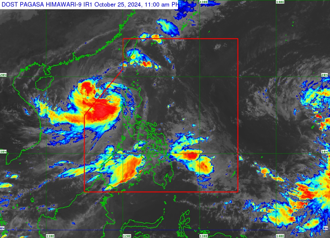
In its tropical cyclone bulletin issued at 11:00 a.m., the Philippine Atmospheric, Geophysical and Astronomical Services Administration (PAGASA) said “Kristine” was located 255 kilometers west-northwest of Bacnotan, La Union or west-southwest of Sinait, Ilocos Sur, moving west-northwestward at 15 kilometers per hour (kph).
The severe tropical storm packs maximum sustained winds of 95 kph and gustiness of up to 115 kph.
In its track forecast, PAGASA said Kristine may exit the PAR Friday afternoon or evening.
In a press briefing, PAGASA weather forecaster Chenel Dominguez said the “Fujiwhara effect” may cause Kristine to loop counterclockwise over the West Philippine Sea into the direction of the PAR Sunday (Oct. 27) and Monday (Oct. 28).
Dominguez explained that this scenario depends on several factors, such as the interaction of Kristine with the northeasterly windflow, southwesterly windflow, and the tropical depression being monitored outside PAR.
“Para po sa kaalaman ng ating mga kababayan, ’yong Fujiwhara effect po ay mababa ang tiyansa sa ngayon, pero hindi po natin inaalis ang posibilidad,” she said.
“Ang Fujiwhara effect po ay mayroon pong interaction ang dalawang bagyo na sa iisang sentro pero ito po ay between 1,500 kilometers po ang pagitan,” she added.
The tropical depression outside PAR was spotted 2,235 km east of Eastern Visayas, moving northwestward at 20 kph, with winds of 55 kph near the center and gustiness of up to 70 kph.
Once it enters the PAR by the weekend, the tropical depression will be given the name “Leon”.
Due to the wider radius of Kristine, several areas in northern and central Luzon have been placed under TCWS No. 2:
- Northwestern portion of mainland Cagayan (Santa Praxedes, Claveria, Sanchez-Mira, Abulug, Pamplona)
- Babuyan Islands
- Nueva Vizcaya
- Apayao
- Abra
- Kalinga
- Mountain Province
- Ifugao
- Benguet
- Ilocos Norte
- Ilocos Sur
- La Union
- Pangasinan
- Nueva Ecija
- Tarlac
- Pampanga
- Zambales
- Northern portion of Bataan (Morong, Hermosa, Dinalupihan, Bagac, Orani, Samal, Abucay, City of Balanga)
TCWS No. 1 is likewise raised in the following areas in Luzon and Visayas:
- Batanes
- Rest of mainland Cagayan
- Isabela
- Quirino
- Aurora
- Bulacan
- Rest of Bataan
- Metro Manila
- Cavite
- Batangas
- Laguna
- Rizal
- Quezon
- Occidental Mindoro
- Oriental Mindoro
- Marinduque
- Romblon
- Northern portion of Palawan (El Nido, Taytay, San Vicente, Dumaran, Araceli) including Calamian, Cuyo, and Kalayaan Islands
- Camarines Norte
- Camarines Sur
- Burias Island
- Northern portion of Aklan (Buruanga, Malay, Nabas, Ibajay)
- Northern portion of Antique (Libertad, Pandan) including Caluya Islands
Strong to gale-force winds are also forecast in Mimaropa, Bicol Region, Visayas, Dinagat Islands, Surigao del Norte, Northern Mindanao, Zamboanga Peninsula, BARMM, SOCCSKSARGEN, and Davao Region.
The advisory on a “minimal to moderate” threat of storm surge of up to two meters above normal tide levels also remains in effect over low-lying, coastal localities of Ilocos Sur, La Union, Pangasinan, and Zambales.
A gale warning is likewise hoisted over the seaboards of Luzon and the western seaboard of Visayas.
Meanwhile, the public is also warned of possible flooding and landslides from moderate to heavy rains that may still batter Pangasinan, La Union, Benguet, Tarlac, Pampanga, Zambales, Bataan, Palawan, Western Visayas, Negros Occidental, the southern portion of Negros Oriental, and Zamboanga Peninsula.