
By Brian Campued
Tropical Cyclone Leon has weakened into a typhoon as it approaches the eastern coast of Taiwan, the state weather bureau said Thursday.
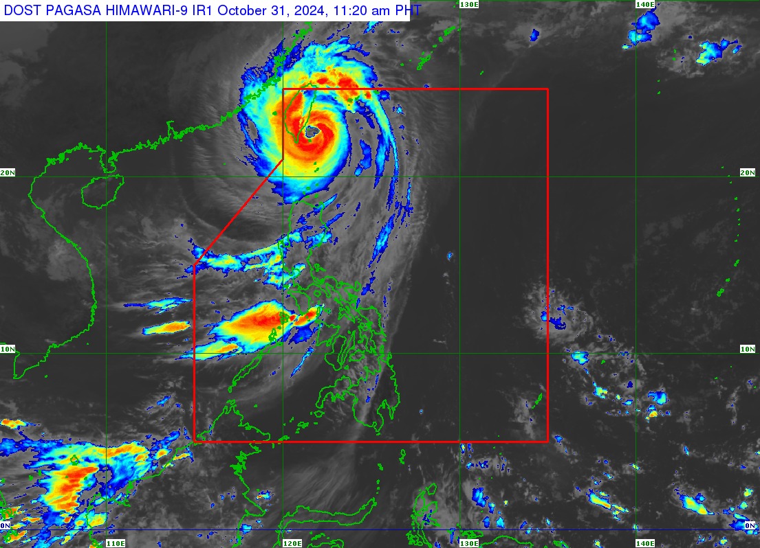
In its tropical cyclone bulletin issued at 11:00 a.m., the Philippine Atmospheric, Geophysical and Astronomical Services Administration (PAGASA) said the eye of Typhoon Leon was located 155 kilometers north of Itbayat, Batanes, moving northwestward at 25 kilometers per hour.
Leon packs maximum sustained winds of 175 kph and gustiness of up to 215 kph.
Tropical Cyclone Wind Signal (TCWS) No. 3 remains hoisted in Batanes, while Babuyan Islands is under TCWS No. 2.
TCWS No. 1 is still raised in the following areas in Northern Luzon:
- Mainland Cagayan
- Isabela
- Apayao
- Abra
- Kalinga
- Mountain Province
- Ifugao
- Northern portion of Benguet (Mankayan, Bakun, Buguias)
- Ilocos Norte
- Ilocos Sur
Leon will also bring strong to gale-force winds in most of Cordillera Administrative Region, Quirino, Nueva Vizcaya, Aurora, Bataan, Metro Manila, Calabarzon, MIMAROPA, Bicol Region, Northern Samar, and most of Western Visayas today.
PAGASA said that heavy to intense rainfall is expected in Batanes until Friday noon (Nov. 1), while moderate to heavy rains are forecast in Babuyan Islands, Ilocos Norte, Ilocos Sur, Benguet, La Union, Pangasinan, Zambales, Bataan, Occidental Mindoro, and Calamian Islands.
The agency also raised a “high risk” threat of storm surge, exceeding three meters above normal tide levels, in Batanes and Babuyan Islands.
Meanwhile, a gale warning remains hoisted in the seaboard of Northern Luzon.
In its track forecast, PAGASA said Leon is forecast to make landfall in Taiwan this Thursday afternoon and may exit the Philippine Area of Responsibility by Thursday evening or Friday morning.
—iro