
By Alec Go
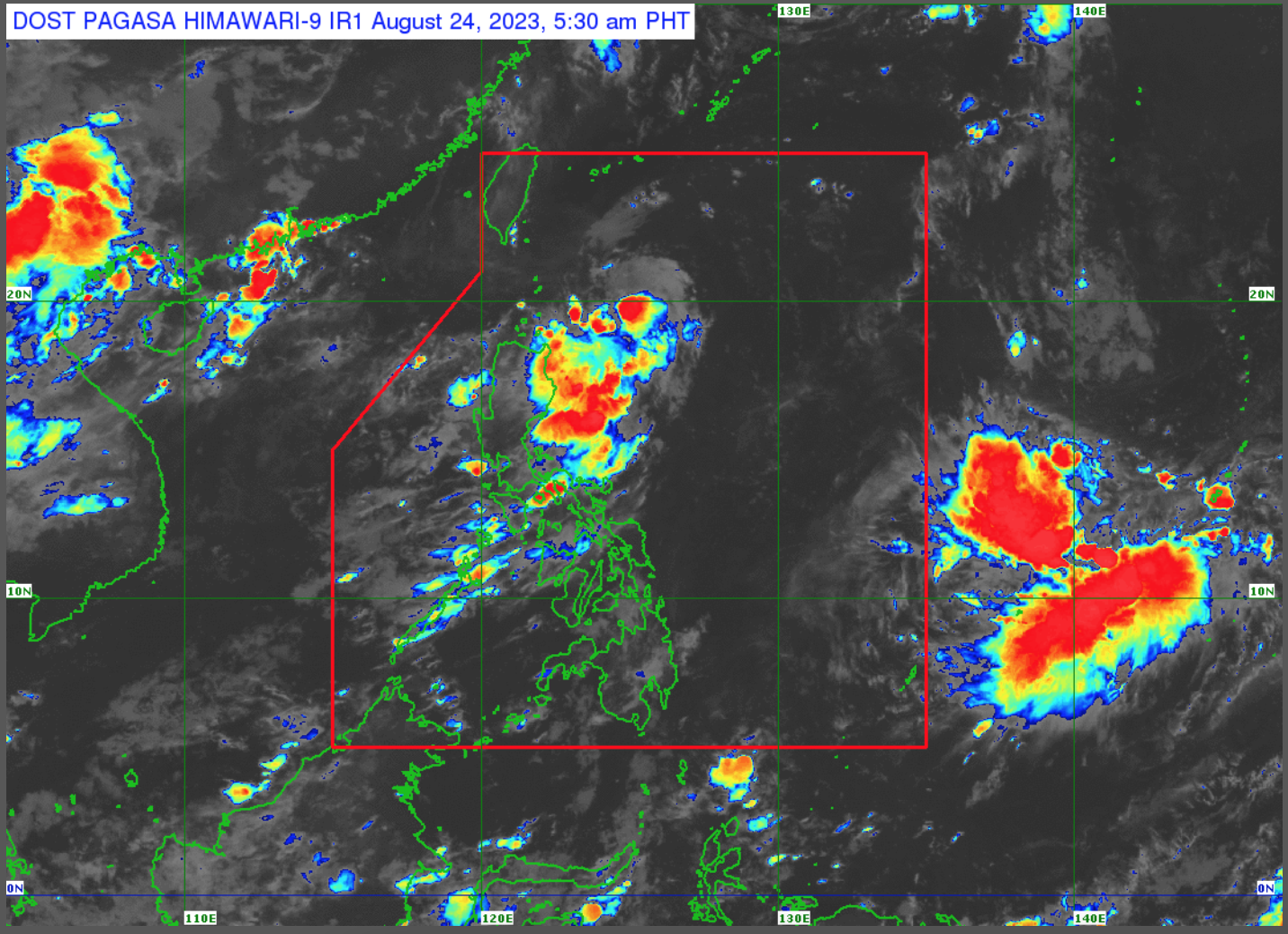
The low pressure area east of Aparri, Cagayan has developed into a tropical depression with the domestic name “Goring”, while the southwest monsoon or habagat will continue to affect Southern Luzon, Visayas, and Mindanao, the state weather bureau said Thursday, Aug. 24.
As of 4:00 a.m., the the center of “Goring” was estimated at 400 kilometers (km) east of northeast Aparri or 405 km east of Calayan, Cagayan.
It is moving west northwestward slowly with maximum sustained winds of 55 km per hour (km/h) near the center and gustiness of up to 70 km/h.
The trough of “Goring” will bring cloudy skies with scattered rain showers and thunderstorms over Cagayan Valley and the Cordillera Administrative Region, which may trigger flooding or landslides due to moderate with at times heavy rains.
“Magiging kakaiba ang pagkilog nitong Bagyong ‘Goring’ dahil magkakaroon ng pag-ikot or looping track sa susunod na limang araw,” Philippine Atmospheric, Geophysical and Astronomical Services Administration (PAGASA) weather specialist Benison Estareja said.
“For the next 12 hours, kikilos pahilaga ang Bagyong ‘Goring’. Then simula bukas hanggang sa Lunes or over the long weekend, kikilos pa-timog in general at inaasahang lalakas pa into a tropical storm by tomorrow at typhoon category pagsapit ng Lunes,” he added.
By late Monday or Tuesday, Estareja said it may likely return to a more northward movement and may remain a typhoon. It is forecast to stay within the Philippine area of responsibility (PAR) for two more days moving west northwest until it leaves PAR by late Wednesday or Thursday.
“Ibig sabihin, nasa isang linggo pang mananatili sa loob ng ating PAR itong si Bagyong ‘Goring’,” he said.
“Bulod sa epekto nito sa may Cagayan Valley ay mag-e-enhance din ito ng habagat o southwest monsoon over many areas of the country,” he added.
In its daily weather bulletin, PAGASA said habagat will continue to bring cloudy skies with scattered rain showers and thunderstorms over Visayas, MIMAROPA, Bicol Region, Zamboanga Peninsula, Northern Mindanao, and BARMM.
Metro Manila and the rest of the country are forecast to experience partly cloudy to cloudy skies with isolated rain showers or thunderstorms also due to habagat or localized thunderstorms.
Meanwhile, PAGASA said the other tropical depression monitored outside PAR or 2,970 km east of northern Luzon does not have any direct effect on the country and is not expected to enter PAR.