
By Dean Aubrey Caratiquet
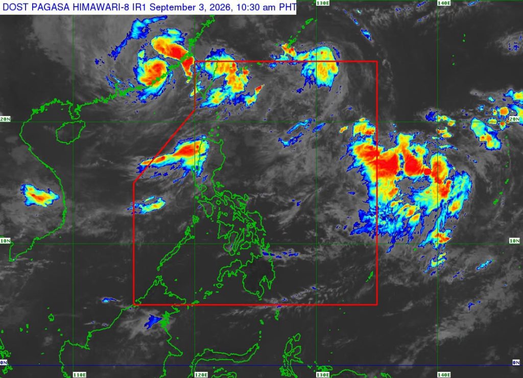
After being closely monitored by PAGASA over several days, Tropical Storm Pilandok has exited the Philippine area of responsibility (PAR) Thursday.
In PAGASA’s 11:00 a.m. update, Pilandok (international name: Krovanh) was last located 1,050 km northeast of extreme northern Luzon, packing maximum sustained winds of 85 kph and gustiness of up to 105 kph as it moves northward at 30 kph.
Due to its distance from the Philippine landmass, no wind signals or gale warnings were issued by PAGASA. However, the state weather bureau advised fisherfolk and owners of small vessels not to venture out to open waters due to rough seas over the following coastal waters:
- Up to 4.0 m: The western and southern seaboards of Batanes; the western seaboard of Babuyan Islands; the northern seaboard of Ilocos Norte;
- Up to 3.5 m: The remaining seaboards of Batanes and Ilocos Norte; the seaboards of Ilocos Sur, La Union, and Zambales; the western seaboard of Pangasinan; the western and southern seaboards of Bataan; the northern and western seaboards Lubang Islands; the northwestern seaboard of Occidental Mindoro.
- Up to 3.0 m: The remaining seaboards of Babuyan Islands; the western seaboards of Cavite, Batangas, northern Occidental Mindoro; the northwestern seaboards of Calamian Islands, and Kalayaan Islands.
Outside the PAR, Pilandok is expected to move generally northwestward towards Southern Japan, remaining a tropical storm throughout the entire forecast period.
Meanwhile, the state weather bureau said that El Niño will continue to enhance the southwest monsoon (habagat) and interact with tropical cyclones entering the PAR, which may bring occasional rains over certain parts of the country.
jpv

