
By Alec Go
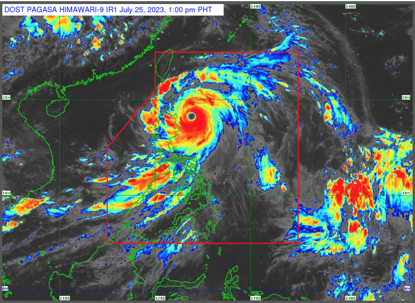
Super Typhoon “Egay” has maintained its strength on Tuesday afternoon, July 25, and Tropical Cyclone Wind Signal (TCWS) No. 5 has been hoisted over portions of Babuyan Islands, the state weather bureau said.
As of 1:00 p.m., “Egay” was located 230 kilometers (km) east northeast of Tuguegarao City, Cagayan or 240 km east of Aparri, Cagayan with maximum sustained winds of 185 km per hour (km/h) near the center and gustiness of up to 230 km/h.
PAGASA said the super typhoon is expected to keep moving northwestward in the next 12 hours.
“Kapag hindi magbabago ang direksiyon at bilis ng bagyo, inaasahan natin itong lalapit o magla-landfall sa Babuyan Islands, northeastern mainland Cagayan area pagitan ng late evening today and tomorrow morning,” PAGASA forecaster Aldczar Aurelio said.
“Ngayon at bukas, inaasahan natin ang malalakas na pag-ulan lalo ngayong araw na may mas malakas na pag-ulan sa northern Luzon,” he added.
Aurelio said “Egay” may bring Intense to torrential rains over mainland Cagayan, Babuyan Islands, Batanes, Ilocos Norte, and Ilocos Sur.
Heavy to intense rains may also prevail over the northern portion of La Union and western portion of Kalinga, while moderate to heavy rains may prevail over Isabela, northern portion of Zambales, and the rest of Ilocos and Cordillera regions.
PAGASA said there is a “high risk of storm surge” resulting in flooding in low-lying and exposed coastal areas of Batanes, Cagayan including Babuyan Islands, Isabela, and Ilocos Norte, with maximum surge heights possibly exceeding 3 meters.
A gale warning is also in effect over the seaboards of Luzon and Visayas and Northeastern Mindanao.
PAGASA said “Egay”, which reached super typhoon category on Tuesday morning, “is nearing its peak intensity” and may exit the Philippine area of responsibility by Thursday morning.
Meanwhile, the southwest monsoon is forecast to bring occasional and monsoon rains over the western portions of Central Luzon, Southern Luzon, and Visayas in the next three days.