
By Christine Fabro
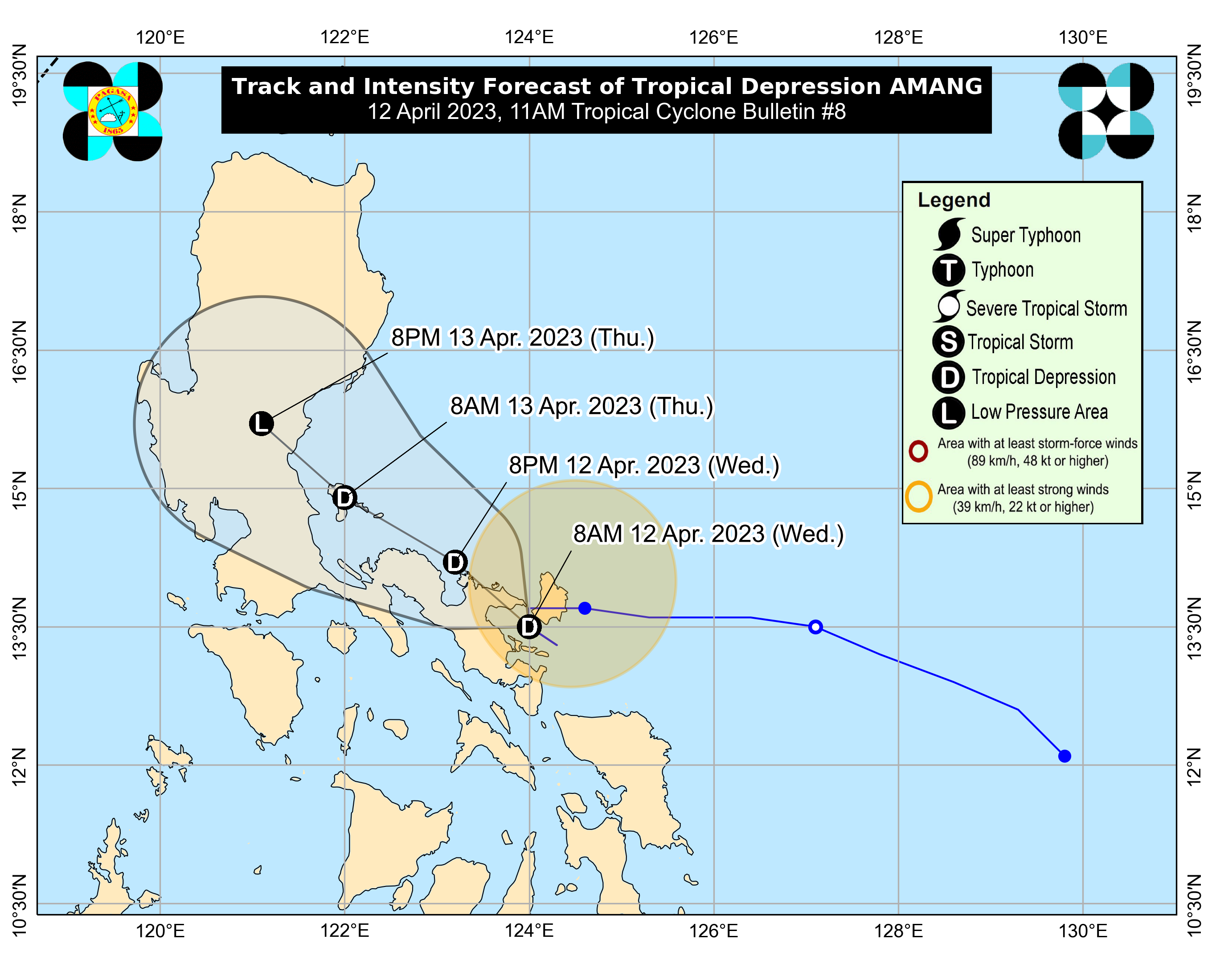
More areas in Luzon have been placed under Tropical Cyclone Wind Signal (TCWS) No. 1 on Wednesday morning, April 12, as Tropical Depression “Amang” maintains strength as it meanders over the Lagonoy Gulf.
TCWS Signal No. 1 is hoisted over these areas based on the 11:00 a.m. bulletin of the Philippine Atmospheric, Geophysical and Astronomical Services Administration (PAGASA):
- Catanduanes
- Sorsogon
- Albay
- Camarines Sur
- Camarines Norte
- Burias Island
- Ticao Island
- Laguna (Liliw, Magdalena, Majayjay, Luisiana, Cavinti, Pagsanjan, Santa Cruz, Lumban, Kalayaan, Paete, Pakil, Pangil, Siniloan, Famy, Santa Maria, Mabitac, Pila)
- Aurora
- Quezon (City of Tayabas, Pitogo, San Andres, Buenavista, San Francisco, Calauag, Pagbilao, Infanta, Lopez, Catanauan, Mulanay, Guinayangan, Unisan, General Luna, Plaridel, Quezon, Alabat, Lucban, Sampaloc, Padre Burgos, Macalelon, Mauban, General Nakar, Perez, Agdangan, Gumaca, Atimonan, Real, San Narciso, Tagkawayan), including Polillo Islands
- Rizal (Tanay, Pililla, Jala-Jala, Rodriguez, Baras, City of Antipolo)
- Bulacan (Norzagaray, Doña Remedios Trinidad)
- Nueva Ecija (Gabaldon, Bongabon, Laur, General Tinio)
“These areas may experience strong winds (strong breeze to near gale strength) associated with the tropical depression which may cause minimal to minor impacts to life and property,” PAGASA noted.
The center of “Amang” was last estimated over the coastal waters of Caramoan, Camarines Sur, with maximum sustained winds of 45 kilometers per hour (km/h) near the center and gustiness of up to 55 km/h.
According to PAGASA, “Amang” is forecast to weaken into a low pressure area “possibly earlier” by Thursday, April 13, due to the “combined effects of land interaction, dry air intrusion, and increasing vertical wind shear.” – gb