
By Dean Aubrey Caratiquet
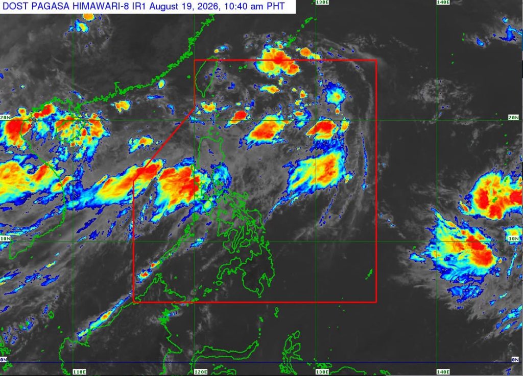
After intensifying from a low pressure area (LPA) into a tropical depression at 2:00 p.m. on Monday, Neneng maintained its strength as it moves northwestward over the sea east of southern Taiwan.
According to PAGASA’s 11:00 a.m. bulletin on Wednesday, the weather system was last located 530 km east-northeast of Itbayat, Batanes, packing maximum sustained winds of 55 kph and gustiness of 70 kph as it moves northwestward at 30 kph.
Because of its distance from the Luzon mainland, the state weather bureau has not issued any Tropical Cyclone Wind Signal in any part of the country, nor any gale warning advisory across the country’s seaboards.
However, PAGASA advises fisherfolk and owners of small marine vessels to exercise caution when venturing into open water due to rough seas over the following coastal areas:
- Up to 3.5 m: The seaboards of Ilocos Norte, Zambales, and Lubang Islands; the western seaboards of Batanes, Babuyan Islands, Pangasinan, Bataan, and Kalayaan Islands.
- Up to 3.0 m: The seaboards of Ilocos Sur and La Union; the remaining seaboards of Batanes and Pangasinan; the western seaboards of Batangas and Occidental Mindoro; the northern and western seaboards of Calamian Islands; the southern seaboard of Bataan; the northern seaboard of Kalayaan Islands.
Neneg is expected to move generally west-northwestward and may pass close or make landfall over the northern coast of Taiwan on Thursday afternoon or evening.
It is likewise expected to remain as a tropical depression over the Philippine Sea throughout the forecast period over the next 36 hours before gradually weakening into a remnant low pressure area.
Meanwhile, PAGASA is also monitoring two other weather systems outside the Philippine Area of Responsibility. As of 10:00 a.m., these were last located 805 km west of Extreme Northern Luzon and 3,015 km east of northeastern Mindanao, respectively.
av

