
By Brian Jules Campued
Tropical Cyclone Wind Signal (TCWS) No. 2 is now up in some areas due to the slight intensification of Typhoon Carina (international name: Gaemi) as it veered northward over the Philippine Sea on Tuesday, according to the Philippine Atmospheric, Geophysical, and Astronomical Services Administration (PAGASA).
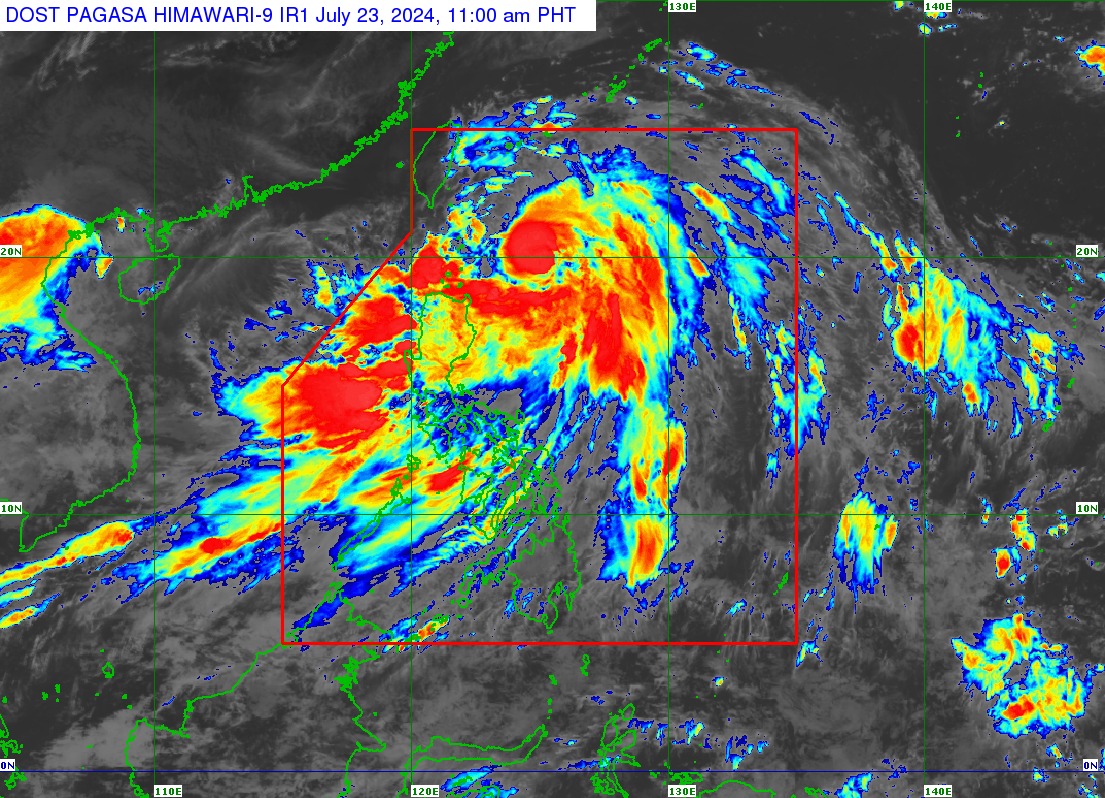
In its tropical cyclone bulletin issued at 11:00 a.m., PAGASA said Carina was located 320 kilometers east of Basco, Batanes or 405 kilometers east northeast of Appari, Cagayan, moving northward at 15 kilometers per hour.
The tropical depression packs maximum sustained winds of 140 kph near its center and gustiness of up to 170 kph.
The state weather bureau also said that the following areas in Batanes are now under TCWS No. 2:
- Itbayat
- Basco
- Mahatao
- Uyugan
- Ivana
Signal No. 1 is hoisted over the following areas in Luzon:
- Rest of Batanes (Sabtang)
- Cagayan, including Babuyan Islands
- Eastern portion of Isabela (Divilacan, Palanan, Maconacon, Dinapigue, Tumauini, Ilagan City, San Mariano, Cabagan, San Pablo, and Santa Maria)
- Northern portion of Apayao (Calanasan, Luna, Pudtol, Flora, and Santa Marcela)
- Northern portion of Ilocos Norte (Pagudpud, Bangui, Adams, Dumalneg, Burgos, and Vintar)
- Northern portion of Aurora (Dilasag and Casiguran)
- Polillo Islands
- Calaguas Islands
- Northern portion of Catanduanes (Pandan, Bagamanoc, Panganiban, Viga, Gigmoto, and Caramoran)
In its track forecast, PAGASA said Carina may exit the Philippine Area of Responsibility after it made landfall in Taiwan between Wednesday evening (July 24) or Thursday (July 25).
While the typhoon will remain far from the Philippine landmass, state meteorologists said it is also forecast to intensify steadily before making landfall in Taiwan.
Carina will also enhance the southwest monsoon or “habagat”, bringing moderate to intense rainfall in the western portion of Luzon until Thursday. – iro