
By Alec Go
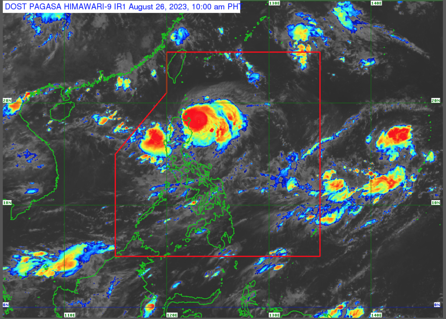
The state weather bureau has raised Tropical Cyclone Wind Signal (TCWS) No. 3 over portions of Cagayan and Isabela as Typhoon “Goring” steadily intensifies moving south southwestwardly over east of Babuyan Island waters on Saturday morning, Aug. 26.
In Philippine Atmospheric, Geophysical and Astronomical Services Administration’s (PAGASA) latest bulletin, the typhoon’s center was estimated at 155 kilometers (km) east of Aparri, Cagayan with maximum sustained winds of 150 km per hour (km/h) near the center and gustiness of up to 185 km/h.
It is moving at 10 km/h.
Wind signals are hoisted over the following areas as of 11:00 a.m.:
TCWS No. 3
- Northeastern portion of Cagayan (Santa Ana)
- Extreme eastern portion of Isabela (Divilacan, Palanan)
TCWS No. 2
- Eastern portion of Isabela (Dinapigue, San Mariano, Ilagan City, Maconacon, Cabagan, Tumauini, San Pablo)
- Eastern portion of Cagayan (Peñablanca, Baggao, Gattaran, Lal-Lo, Gonzaga, Santa Teresita, Buguey),
- Northern portion of Aurora (Dilasag, Casiguran)
TCWS No. 1
- Batanes
- Rest of Cagayan including Babuyan Islands
- Central portion of Aurora (Dinalungan, Dipaculao)
- Quirino
- Apayao
- Kalinga
- Rest of Isabela
- Eastern portion of Nueva Vizcaya (Kasibu, Quezon, Diadi, Bagabag, Solano, Villaverde)
- Eastern portion of Ifugao (Lamut, Lagawe, Hingyon, Banaue, Mayoyao, Aguinaldo, Alfonso Lista)
- Eastern portion of Mountain Province (Barlig, Natonin, Paracelis)
Heavy rainfall is expected over mainland Cagayan and Isabela, Babuyan Islands, the northern portion of Aurora, the Cordillera Administrative Region, and Ilocos Region until Sunday noon.
PAGASA said “Goring” will bring stormy weather conditions over the eastern portion of Cagayan, which may result in flooding and landslides, and poses “minor to moderate threat to lives and properties due to strong winds.”
“Goring” will also bring rains and gusty winds over Batanes, Isabela, Aurora, and the rest of Cagayan that may cause flooding and landslides, with “minimal to minor threat to lives and properties due to strong winds.”
The typhoon’s through will bring cloudy skies with scattered to widespread rains and thunderstorms over the Cordillera Administrative Region, Ilocos Region, and the rest of Cagayan Valley.
Meanwhile, the southwest monsoon or “habagat” will bring cloudy skies with scattered rain showers and thunderstorms over Metro Manila, Calabarzon, Mimaropa, and the rest of Central Luzon.
The rest of the country will have partly cloudy to cloudy skies with isolated rain showers or thunderstorms due to “habagat” and localized thunderstorms.
A Gale Warning is currently in effect over the northern and eastern coastal waters of northern Luzon and the eastern coastal waters of Central Luzon.
PAGASA said “Goring” may further intensify and become a super typhoon on Monday due to the highly favorable environment.
However, “upwelling of cooler waters due to its slow movement will limit further intensification by late Monday or early Tuesday.”
PAGASA said the typhoon may exit its looping path on Tuesday. – gb