
By Dean Aubrey Caratiquet
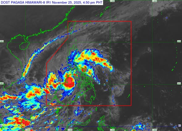
After crossing Visayas on Monday, Tropical Depression Verbena is now hovering over the waters of Cuyo archipelago, according to PAGASA’s 5:00 p.m. weather bulletin.
Verbena was last located over the coastal waters of Cuyo, Palawan, packing maximum sustained winds of 55 kph near the center and gustiness of up to 70 kph, as it continues to move westward at 25 kph.
Tropical Cyclone Wind Signal (TCWS) No. 1 is hoisted over Occidental Mindoro, Oriental Mindoro, the southern portion of Romblon (Santa Fe, Ferrol, Looc, San Jose), the northern and central portions of Palawan (Araceli, Taytay, El Nido, Dumaran, Roxas, San Vicente, Puerto Princesa City) including Calamian, Cuyo, and Cagayancillo Islands, Antique and the northwestern portion of Aklan (Malay, Buruanga, Nabas).
PAGASA issued a gale warning advisory over the seaboards of Northern Luzon, with 3.4-5.5 meter high waves expected in the coastal waters of Batanes, and 3.1-5.5 meter high waves over Ilocos Norte and Cagayan (including Babuyan Islands), making travel risky for small marine vessels.
The state weather bureau, meanwhile, noted that Tropical Depression Verbena is expected to make landfall over the northern portion of Palawan on Tuesday night, before emerging over the West Philippine Sea on Wednesday (Nov. 26).
PAGASA is also not ruling out the possibility of Verbena’s further intensification, possibly reaching tropical storm category within the next 6 to 12 hours.
av