
By Dean Aubrey Caratiquet
After intensifying into a tropical storm on Tuesday, Pilandok changed direction as it continues on a highly uncertain forecast track over the Philippine Sea
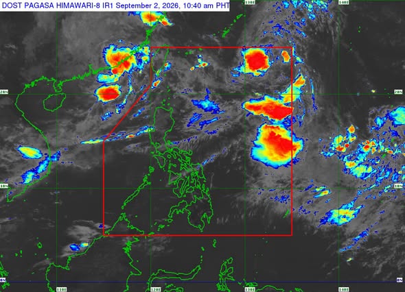
In PAGASA’s 11:00 a.m. update, Pilandok (international name: Krovanh) was last located 1,035 km east northeast of extreme northern Luzon, packing maximum sustained winds of 65 kph and gustiness of up to 80 kph as it moves northeastward at 10 kph.
Due to its distance from the Philippine landmass, no wind signals or gale warnings were issued by PAGASA. However, the state weather bureau advised very rough seas over the following coastal waters:
- Up to 5.0 m: The seaboards of Batanes, Ilocos Norte, and northern Ilocos Sur; the northern and western seaboards of Babuyan Islands.
- Up to 4.5 m: The seaboard of La Union; the western seaboard of Pangasinan; the remaining seaboards of Babuyan Islands and Ilocos Sur.
Fisherfolk and owners of small vessels are likewise advised not to venture out to open waters due to rough seas over the following coastal waters:
- Up to 4.0 m: The seaboard of Zambales; the western seaboard of Bataan.
- Up to 3.5 m: The seaboard of Lubang Islands; the southern seaboard of Bataan; the western seaboards of Cavite, Batangas, and northern Occidental Mindoro.
- Up to 3.0 m: The northern and western seaboards of Calamian Islands and Kalayaan Islands; the western seaboard of northern Palawan.
Tropical Storm Pilandok is forecast to remain as a tropical storm as it moves northwestward for the remainder of the forecast period and will remain distant from the Philippine landmass.
PAGASA, likewise, added that the weather system is likely to exit the Philippine area of responsibility (PAR) Wednesday night or Thursday morning (Sept. 3).
Pilandok is expected to enhance the effects of southwest monsoon (habagat), which continues to bring rainfall over several regions in the Philippines.
jpv

