
By Jose Cielito Reganit | Philippine News Agency
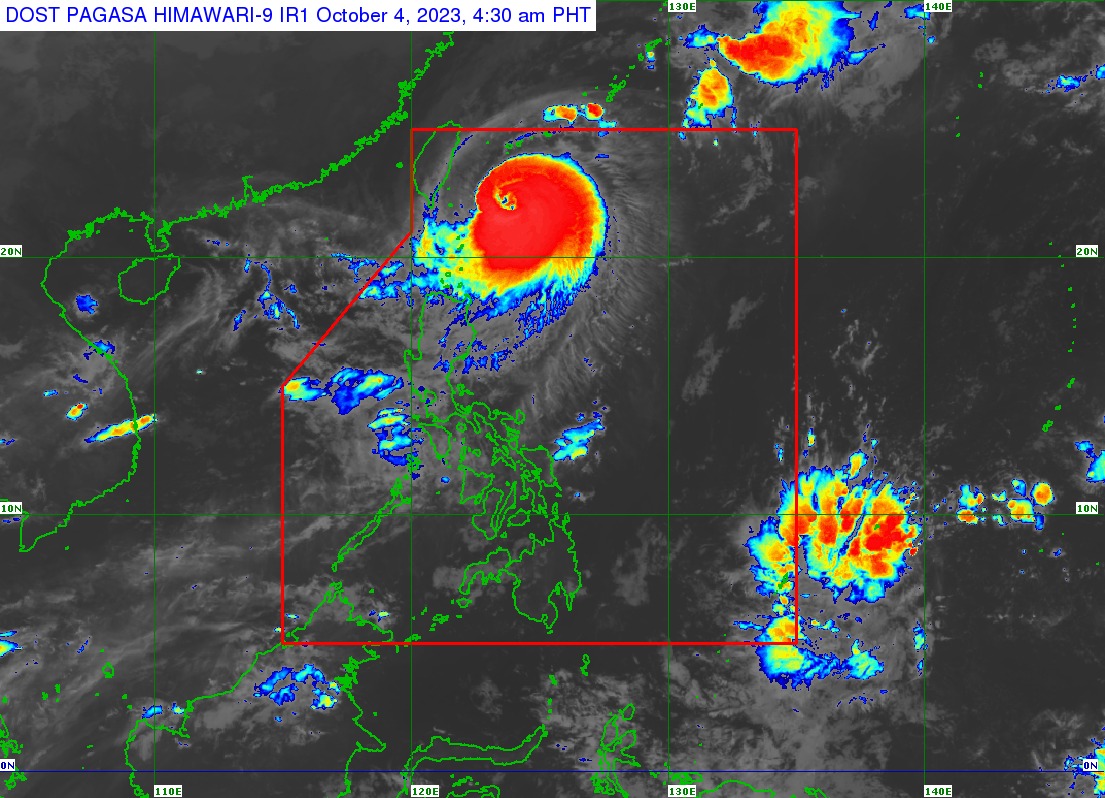
Tropical Cyclone Wind Signal (TCWS) No. 3 is hoisted over Itbayat, Batanes as Typhoon “Jenny” started its west-northwestward turn towards Taiwan, the weather bureau said Wednesday.
“Jenny” was last tracked 270 kilometers east northeast of Itbayat, Batanes with maximum sustained winds of 150 kilometers per hour (kph) near the center and gustiness of up to 185 kph, and moving west-northwestward at 10 kph.
Meanwhile, TCWS Signal No. 2 is hoisted over the rest of Batanes and the northern portion of Babuyan Islands (Babuyan Is., Calayan Is.).
TCWS No. 1 is hoisted over the rest of Babuyan Islands; the northern portion of mainland Cagayan (Santa Ana, Gonzaga, Buguey, Santa Teresita, Lal-Lo, Camalaniugan, Pamplona, Claveria, Aparri, Ballesteros, Abulug, Allacapan, Sanchez-Mira, Santa Praxedes, Lasam, Gattaran); the northern portion of Apayao (Calanasan, Pudtol, Luna, Santa Marcela, Flora); and the northern portion of Ilocos Norte (Piddig, Bangui, Vintar, Burgos, Pagudpud, Bacarra, Adams, Pasuquin, Carasi, Dumalneg, Laoag City).
Batanes and Babuyan Islands will experience stormy weather, while mainland Cagayan, Isabela, Apayao, Kalinga, Abra, and Ilocos Norte will have rains with gusty winds.
The Philippine Atmospheric, Geophysical and Astronomical Services Administration (PAGASA) said “Jenny” is forecast to move west-northwestward in the next 12 hours, then westward thereafter.
Based on the track forecast, the typhoon will make landfall over the southern portion of Taiwan on Thursday morning, and then exit the Philippine area of responsibility (PAR) in the afternoon or evening on the same day.
PAGASA said “Jenny” will continue to enhance the southwest monsoon or “habagat” causing occasional rains over the rest of Cagayan Valley, Cordillera Administrative Region, and Ilocos Region.
Metro Manila, Calabarzon, the rest of Central Luzon, and the rest of Mimaropa will have cloudy skies with scattered rain showers and thunderstorms while the rest of the country will have partly cloudy to cloudy skies with isolated rain showers or thunderstorms.
Extreme Northern Luzon will experience strong wind conditions with rough seas, while the rest of Luzon will have moderate to strong winds with moderate to rough seas.
The Visayas and Mindanao will have light to moderate winds with slight to moderate seas.

